filmov
tv
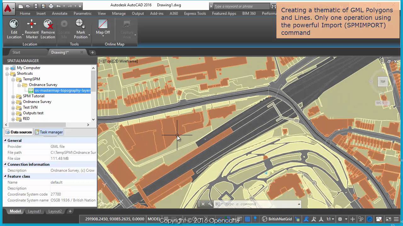
Ordnance Survey data, image and maps (AutoCAD - part 1) - Spatial Manager TP
Показать описание
Description
 0:02:49
Ordnance Survey data, image and maps (BricsCAD - part 1) - Spatial Manager TP
 0:02:43
Ordnance Survey data, image and maps (ZWCAD - part 1) - Spatial Manager TP
 0:03:11
Ordnance Survey data, image and maps (AutoCAD - part 1) - Spatial Manager TP
 0:02:20
Ordnance Survey data, image and maps (AutoCAD - part 2) - Spatial Manager TP
 0:03:00
Ordnance Survey data, image and maps (BricsCAD - part 2) - Spatial Manager TP
 0:02:30
Ordnance Survey data, image and maps (ZWCAD - part 2) - Spatial Manager TP
 0:30:41
Ordnance Survey and Deep Learning: Going Deeper
 0:00:56
Ordnance Survey mapping products
 0:30:50
Geospatial data and services
 0:02:25
Learn more about raster and vector map data
 0:01:11
Ordnance Survey Mapping in AutoCAD - KeyOSC
 0:24:24
Python at Ordnance Survey
 0:13:22
Part 1: Level Up your Mapping by Using Ordnance Survey Mastermap®
 0:18:13
How To: Work with Ordnance Survey data
 0:01:53
OS story
 0:23:48
OS and ESRI webinar - loading OS MasterMap Topography data into ArcGIS
 1:01:23
An Introduction to the OS Data Hub
 0:44:21
Ordnance Survey - How to use mapping data in Autodesk Software
 0:00:35
Mobileye & Ordnance Survey Gather Map Data to Manage Infrastructure for Smarter Cities & Saf...
 0:01:53
FindIT - Select an OS MasterMap Feature
 0:29:30
Bringing Geospatial to Data Science vs Data Science to Geospatial | Ordnance Survey
 0:01:19
GIS: How to load Ordnance Survey OpenSpace in QGIS?
 0:02:13
OS Select+Build: How to download a data package
![[Webinar] How Ordnance](https://i.ytimg.com/vi/SVoORNMGNe8/hqdefault.jpg) 0:58:09
0:58:09
[Webinar] How Ordnance Survey data and GIS can help social housing providers combat pressing issues
Комментарии