filmov
tv
2015 GEOS-5 Simulation of Hurricane Katrina
Показать описание
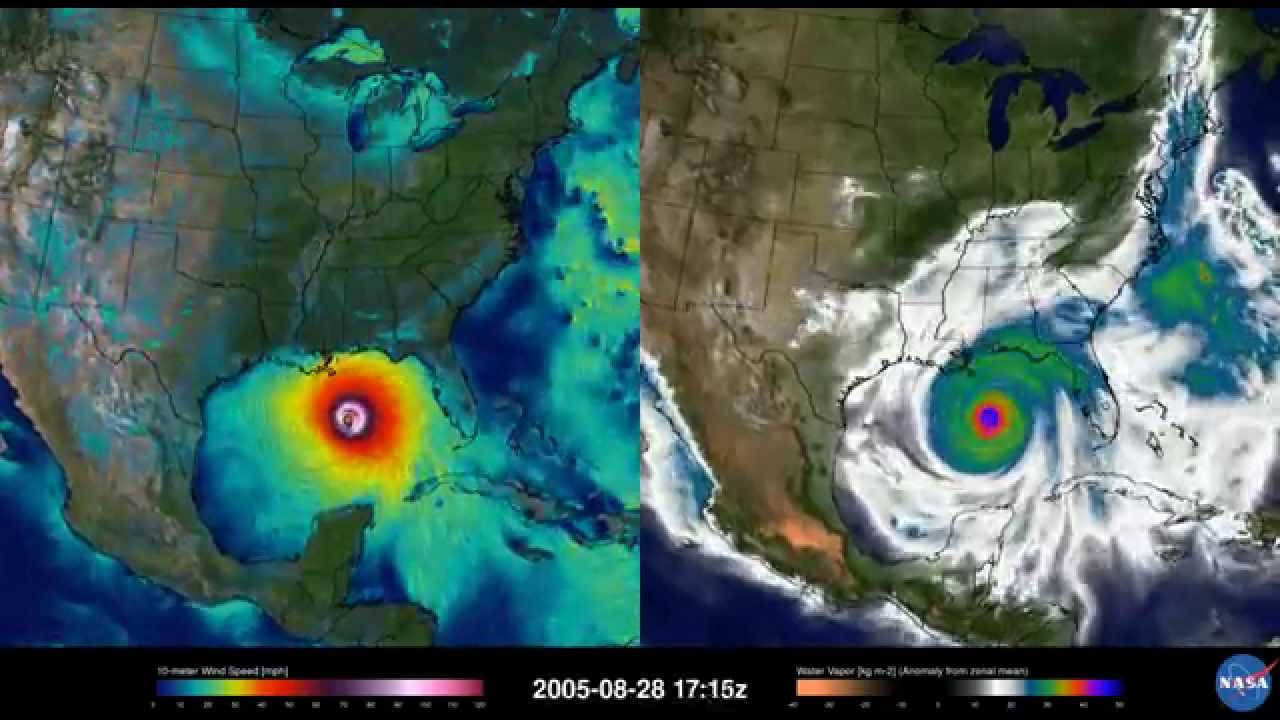
This video, created in 2015, combines observational data every 6-hours with NASA’s high-resolution global model (GEOS-5) to produce a global simulation with a horizontal resolution of approximately 4-miles for the period of Katrina in August 2005. Thanks to higher resolution models with improved representation of physical processes, advanced data assimilation techniques, and better supercomputers, today’s simulations can recreate historical storms in great detail to help scientists study and learn about past events.
In this video, the depression that becomes Katrina drifts north of Hispaniola becoming a tropical storm over the Bahamas on the 24th of August. The right panel shows water vapor, and the left shows wind speeds near the surface. After crossing the southern tip of Florida as a minimal hurricane, Katrina rapidly intensified to a Category 5 hurricane over the warm waters of the Gulf of Mexico from the 26th to the 28th. During this period of intensification, a strong core of intense winds surrounds the compact eye of Katrina while bands of moisture feeding into the circulation can be seen in the water vapor images. Katrina makes landfall along the coast of Louisiana on August 29th as a Category 3 hurricane with wind speeds in excess of 120 mph. The moist low-lying geography of the lower Mississippi valley into New Orleans do little to weaken the strength of Katrina's winds as it moves north making a final landfall near the Louisiana/Mississippi border. Advances in science and computing allow modern global models to represent all aspects of Katrina's life cycle. These advances have lead to substantial improvements in forecasts of hurricane landfall and intensity.
Caption provided by Bill Putman at NASA’s Goddard Space Flight Center in Greenbelt, Maryland
 0:00:33
 0:00:33
 0:00:33
 0:00:44
 0:01:38
 0:00:38
 0:02:15
 0:00:06
 0:01:35
 0:00:57
 0:07:28
 0:00:41
 0:01:31
 0:00:15
 0:02:58
 0:00:22
 0:03:25
 0:00:20
 0:06:24
 0:01:11
 0:00:33
 0:00:35
 0:00:15
 0:00:19