filmov
tv
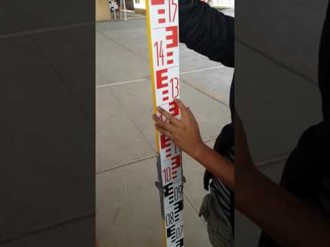
[Topografía] Uso de NIVEL, lectura de ESTADAL y distancias por ESTADIMETRÍA

Показать описание
Video realizado como material de apoyo para la materia de Levantamiento Topográfico de la licenciatura en Arqueología de la Escuela Nacional de Antropología e Historia.
Clases en línea, semestre 2021-2.
Profesor: Cuauhtémoc Reyna Ortiz.
Clases en línea, semestre 2021-2.
Profesor: Cuauhtémoc Reyna Ortiz.
![[Topografía] Uso de](https://i.ytimg.com/vi/sD3Z5Tj_b4w/hqdefault.jpg) 0:14:45
0:14:45
[Topografía] Uso de NIVEL, lectura de ESTADAL y distancias por ESTADIMETRÍA
 0:03:32
Lectura sobre Mira - Nivel de Anteojo - Topografía
 0:02:34
¿Cómo sacar niveles con el nivel topográfico?
 0:06:41
NIVEL TOPOGRÁFICO | EJERCICIO RÁPIDO | CUANDO SUMAR Y CUANDO RESTAR
![[Topografía] Lectura de](https://i.ytimg.com/vi/Q1exFC9kz20/hqdefault.jpg) 0:13:28
0:13:28
[Topografía] Lectura de Estadal y Distancia Estadimétrica
 0:02:30
Como leer una mira topográfica - Demasiado fácil
 0:14:33
CÓMO NIVELAR UN TERRENO (1/2) | NIVEL FIJO Y ESTADAL | TOPOGRAFÍA
 0:06:19
Practica de Topografía sobre Nivelación Simple
 1:56:55
📢1° CLASE LIBERADA🔼 CIVIL 3D APLICADO A LA TOPOGRAFÍA Y EL DISEÑO GEOMÉTRICO DE INFRAESTRUCTURA VIAL...
![[Topografía] Lectura de](https://i.ytimg.com/vi/uY0goz8moeA/hqdefault.jpg) 0:05:02
0:05:02
[Topografía] Lectura de Hilos con Nivel topográfico
 0:03:50
Lectura de la mira topografica
 0:04:47
Control de Excavación en Pendiente
![[Topografía] Establecer cota](https://i.ytimg.com/vi/tw6_kbWlr3U/hqdefault.jpg) 0:03:01
0:03:01
[Topografía] Establecer cota a partir de Banco de Nivel externo
 0:07:07
CÓMO NIVELAR UN TERRENO (2/2) | NIVEL FIJO Y ESTADAL | TOPOGRAFÍA
 0:14:29
Uso del nivel topográfico
 0:03:49
Como usar GPS para levantamiento topográfico
 0:05:09
TOPOGRAFIA: Lectura atrás y lectura adelante 2020
 0:09:04
CÓMO HACER UN CAMBIO DE ESTACIÓN CON NIVEL FIJO | TOPOGRAFÍA
 0:15:13
NIVELACION CON NIVEL FIJO
 0:11:45
Topografia na prática - Aula 2: nivelando o nível ótico | Prof. Edgar Demarqui
 0:03:46
Como realizar un levantamiento topográfico con el equipo Trimble modelo R8S 👷
 0:13:00
CLASE 02 MEDICIÓN CON NIVEL OPTICO Y MIRA VERTICAL 01
 0:05:19
TOMA TOPOGRÁFICA (NIVEL ABNEY Y LOCKE) // Altimetría
 0:07:10
introducción a las curvas de nivel
Комментарии