filmov
tv
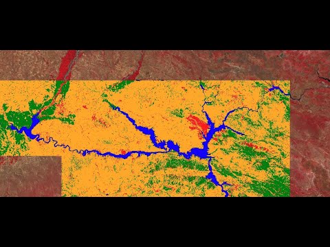
Google Earth Engine 8: Introduction to Image Classification

Показать описание
Another powerful tool of the Google Earth Engine is the capability to classify images. It can be useful for a variety of cases, when you want to create a thematic map of a certain area rather than an image, or when you want to assess what land cover changes took place over a certain time period.
In the Earth Engine there are two ways to classify pixels of an image. You could do a supervised classification or an unsupervised classification.
This video will give an introduction on how to use classifiers in the GEE
In the Earth Engine there are two ways to classify pixels of an image. You could do a supervised classification or an unsupervised classification.
This video will give an introduction on how to use classifiers in the GEE
 0:13:16
Google Earth Engine 8: Introduction to Image Classification
 1:35:07
Google Earth Engine 101: An Introduction for Complete Beginners
 0:18:02
Introduction to Sentinel-1 visualisation in Earth Engine - Lab 8
 0:12:16
Google Earth Engine 1: Introduction to Code Editor - Beginners Guide
 0:16:51
Introduction to Google Earth Engine (GEE)
 0:04:07
Google Earth Engine: Introduction
 0:32:46
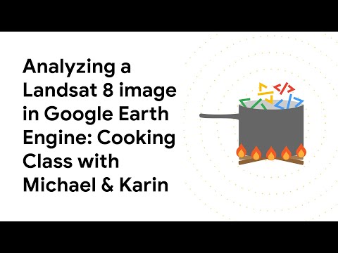
Analyzing a Landsat 8 image in Google Earth Engine
 1:17:06
Google Earth Engine 101 Part 1
 0:20:30
Supervised Classification of Landsat 8 imagery in Google Earth Engine | Part 1
 0:12:40
Loading Landsat 8 data into Google Earth Engine
 0:34:35
Google Earth Engine Complete Course Tutorials: 1. Introduction
 0:54:36
Geo for Good 2022: Intro to Machine Learning and Earth Engine
 0:13:50
Lecture 1 - Introduction to Google Earth Engine | Tutorial for beginners | Platform Code Editor |
 0:13:19
Overview of Earth Engine Platform
 0:32:55
Introduction to Google Earth Engine (End-to-End Google Earth Engine)
 1:07:59
Day 30 - Introduction to Google Earth Engine (GEE )- Image Classification
 0:13:20
A Quick Intro to Google Earth Engine - Lighten Version Video
 0:02:00
Meet Earth Engine
 0:30:00
(1/14) Intro to Earth Engine in JavaScript |Geo for Good 2023
 0:06:28
Introduction to Google Earth Engine
 2:02:24
NASA ARSET: Google Earth Engine Basics and General Applications, Part 1/3
 0:39:49
GEE Lesson 1 - Getting Started with Google Earth Engine
 0:11:30
Google Earth Engine Tutorial - Introduction
 0:10:18
Introduction to the Earth Engine Code Editor
Комментарии