filmov
tv
RS & GIS QA6- How to get all pixcel values from a raster image||prepare Rainfall map from point data

Показать описание
RS & GIS QA6- How to get all pixcel values from a raster image||prepare Rainfall map from point data
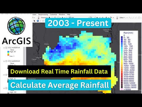
PERSIANN-Cloud Classification System (PERSIANN-CCS) is a real-time global high resolution (0.04° x 0.04° or 4km x 4km;) satellite precipitation product developed by the Center for Hydrometeorology and Remote Sensing (CHRS) at the University of California, Irvine (UCI).
You May Like
Any Help Contact
WhatsApp Number= +918421031398
THANK YOU SO MUCH
#How to extract the pixcel value of satellite Image #prepare Rainfall map from point data #Extract pixcel value of satellite Image
 0:07:08
RS & GIS QA6- How to get all pixcel values from a raster image||prepare Rainfall map from point ...
 0:03:35
RS & GIS QA46 How to Add NetCDF file in QGIS and ArcGIS
 0:03:07
RS & GIS QA-4 How can we get Center of polygon or City || centroid of polygon
 0:08:05
RS & GIS QA15- Download ready-to-use contour lines from Open DEM & Generate DEM from Contour
 0:05:51
RS & GIS QA11- Merge Multiple shapefile into Single Shapefile using ARCGIS and QGIS
 0:02:28
Top #3 Sites To Download GIS Raster Data II For Remote Sensing
 0:01:38
Feature Count
 0:11:58
Cleaning a raster with Region Group, SetNull, and Nibble tools in ArcGIS Pro (L6, V2)
 0:03:37
Gis: How to reclassify all contiguous pixels of the same class in a raster?
 0:06:45
Download Real Time Rainfall Data of Any Area 2003-Present || Calculate Average Rainfall
 0:29:35
Raster data reclassification and area calculation for each class using ArcGIS software
 0:06:18
How to Change Cell/Pixel Size (Resampling) of a Raster Using ArcGIS
 0:06:23
RS & GIS QA5 Download Free India State, District, taluka Shapefile with Jammu, Kashmir, and Lada...
 0:02:39
How to Calculate Area of Raster Image (Classified Image) | How to Calculate Raster Area in ArcGIS
 0:01:58
How to Extract Raster Values to Point in ArcGIS
 0:02:42
Pixel Values In Image Rasters
 0:01:28
GIS: Calculate number of pixels and more variables by classes in QGIS
 0:05:43
Building a statistical dataset from raster and point data in ASrcGis
 0:04:16
RS & GIS QA21- Download Rainfall data from India-WRIS || IMD Grided Data
 0:02:47
HOW TO EXTRACT PIXEL VALUES FOR A POINT SHAPE FILE FROM DIFFERENT LAYERS OF RASTER IN ARC MAP|
 0:04:24
How to Georeferenced a map in arcmap
 0:00:49
How to Convert Features To Point in ArcGIS 10.8 #qgis3 #gis #map #arcmap #googleearth #arcgispro
 0:14:24
RS & GIS QA1: How to Create Watershed using pour point || Delineation of watershed using pour po...
 0:02:50
Resampling rasters in ArcGIS
Комментарии