filmov
tv
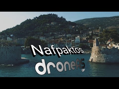
Nafpaktos by drone, Aetolia Acarnania | GREECE 🇬🇷

Показать описание
Nafpaktos (Greek: Ναύπακτος) or Naupactus, is a town and a former municipality in Nafpaktia, Aetolia-Acarnania, West Greece, situated on a bay on the north coast of the Gulf of Corinth, 3 km west of the mouth of the river Mornos.
It is named for Naupaktos (Ναύπακτος, Latinized as Naupactus), an important Athenian naval station in the Peloponnesian war. As a strategically crucial possession controlling access to the Gulf of Corinth, Naupaktos changed hands many times during the Crusades and the Ottoman–Venetian Wars. It was under Venetian control in the 15th century, and came to be known by the Venetian form of its name, Lepanto. It fell to the Ottoman Empire in 1499 and was used as a naval station by the Ottoman Navy in the 16th century, being the site of the decisive victory by the Holy League in the Battle of Lepanto in 1571. Except for a brief period of Venetian control in 1687–1699, Lepanto remained under Ottoman control until Greek independence in 1829.
The town is 9 km northeast of Antirrio, 18 km northeast of Patras, 35 km east of Missolonghi and 45 km southeast of Agrinio. The Greek National Road 48/E65 (Antirrio – Nafpaktos – Delphi – Livadeia) passes north of the town. It is the second largest town of Aetolia-Acarnania, after Agrinio.
Music:
Crystal - Vibe Tracks
About That Oldie - Vibe Tracks
 0:05:39
Nafpaktos by drone, Aetolia Acarnania | GREECE 🇬🇷
 0:02:26
Nafpaktos/Τhe jewel of Etoloacarnania/Μεσαιωνική Ναύπακτος/Το διαμάντι της Αιτωλοακαρνανίας...
 0:02:58
Πύργος Μπότσαρη, Ναύπακτος / Botsaris Tower, Nafpaktos, Aetolia-Acarnania Greece...
 0:01:01
Visit Aetolia-Acarnania and indulge yourself in an unforgettable experience
 0:04:21
Aetolia & Acarnania from above - DJI mavic 2 zoom
 0:04:53
Nafpaktos Greece - Η Ναύπακτος Από Ψηλά
 0:02:44
Ναύπακτος Αιτωλοακαρνανίας | Nafpaktos 4k Greece
 0:03:15
Η Αμπελακιώτισσα (Ν. Αιτωλοακαρνανίας) ΑΝΩΘΕΝ - Aerial video by drones Dji...
 0:02:10
Ο Πλάτανος Ναυπακτίας (Ν. Αιτωλοακαρνανίας) ΑΝΩΘΕΝ - Aerial video by drones Dji...
 0:15:56
Nafpaktos
 0:01:50
Ναύπακτος #mini2 #droneshots #nafpaktos #visitgreece
 0:03:33
Ναύπακτος Αιτωλοακαρνανία - Nafpaktos 2013
 0:04:07
Aitoliko by drone, Aetolia Acarnania | GREECE 🇬🇷
 0:03:37
Ναύπακτος: Το κόσμημα της Αιτωλοακαρνανίας - Nafpaktos
 0:01:50
Γραμμένη Οξυά, Ορ.Ναυπακτία(4K drone)
 0:01:39
Nafpaktos Greece#Greece#film
 0:04:10
Nafpaktos By Dji Spark
 0:01:11
Nafpaktos - Greece | Ναύπακτος - Ελλάδα
 0:02:37
Ναύπακτος & περίχωρα με drone - Nafpaktos & suburns by drone
 0:00:45
Άνω Χώρα #greece #nafpaktia #aitoloakarnania #nafpaktos
 0:00:36
Ναύπακτος Αιτωλοακαρνανίας . Μια πόλη μαγική…🇬🇷
 0:02:39
TRIP#6: Nafpaktos, Greece
 0:03:40
Γέφυρα Μπανιά & Εύηνος Ποταμός | Νομός Αιτωλοακαρνανίας (Δήμος Ναυπακτίας) | Dji Mavic Mini Dron...
 0:00:39
AETOLIA & AKARNANIA, ANCIENT THERMO, SOUTH GALLERY
Комментарии