filmov
tv
ArcGIS Pro: Image Segmentation, Classification and Machine Learning
Показать описание
Extracting information from remotely sensed imagery is an important step to providing timely information for your GIS. ArcGIS Pro desktop provides a rich environment to process and exploit imagery. A significant aspect of this is the image segmentation and classification tools that process multispectral imagery, resulting in extracted feature data for the GIS. These can be combined with a range of machine learning algorithms for the automated feature extraction and identification, and also used as models that can be scaled up using Raster Analytics running on ArcGIS Image Server
 1:03:07
ArcGIS Pro: Image Segmentation, Classification and Machine Learning
 0:05:11
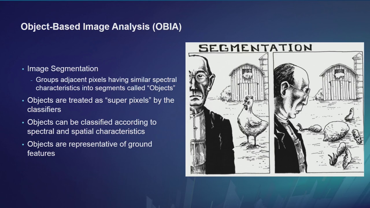
ArcGIS Pro: Image segmentation
 0:05:21
Supervised Classification in ArcGIS Pro
 0:15:31
Image Segmentation in ArcGIS Pro
 0:14:35
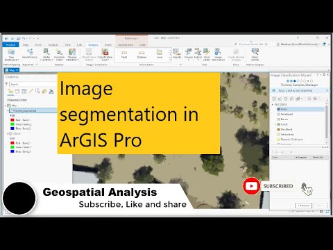
Image segmentation process in ArcGIS Pro
 0:12:38
Deep learning Image classification in ArcGIS Pro || Support Vector Machine Classifier.
 0:11:20
【ArcGIS Pro】Supervised image segmentation and classification | step by steps
 0:16:48
Image classification in ArcGIS Pro step by step on how to create new schema and training samples.
 0:12:48
Image segmentation with SAM model in ArcGIS Pro
 0:00:16
Using segment-geospatial with ArcGIS Pro
 0:14:25
ArcGIS Pro: Machine Learning Classification for Impervious Surfaces
 0:08:46
Image segementation in ArcGIS Pro
 0:22:16
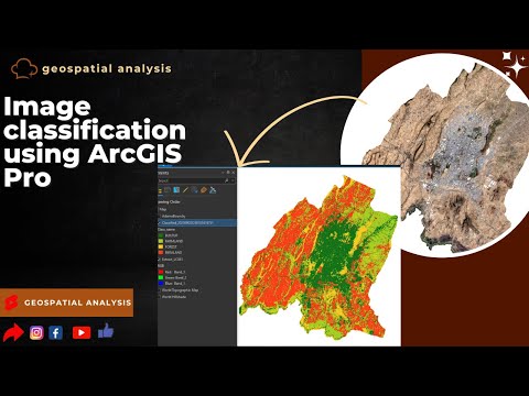
Image classification in ArcGIS Pro
 0:04:23
ArcGIS Pro: Supervised Classification
 0:15:15
How to classify satellite image using ArcGIS Pro P1
 0:06:51
ArcGIS Pro: Assessing the Accuracy of a Classified Image
 0:03:16
Tutorial Image Segmentation in ArcGIS
 0:03:52
Image segmentation with SAM model in ArcGIS Pro
 0:31:50
Image Processing in ArcGIS Pro Complete Tutorial
 0:05:52
ArcGIS Pro: Classification Schema
 0:07:44
Deep Learning Object Detection Workflow in ArcGIS Pro
 0:11:57
Image Classification Demo
 0:02:05
Use the Segment Anything Model in ArcGIS Pro
 0:09:50
Image Classification in ArcGIS Pro - The Basics
Комментарии