filmov
tv
Wildfire Data Technology

Показать описание
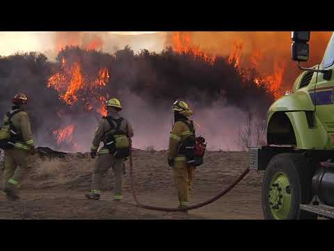
A wildfire becomes a risk long before the first signs of smoke. Low humidity, high temperature, dry soil, high winds, and many other conditions cannot be seen. Incident commanders need crucial data to decide areas of focus around the fire, the path toward containment, safe locations to deploy rescue crews. The stakes could not be higher. Spire provides global data for humidity, temperature, soil moisture, wind, and ten-day forecasts across remote locations, anywhere around the world.
These conditions cannot be seen by the naked eye, but they can be seen by Spire’s satellite constellation. Providing consistent global data to help assess risk maps, areas of priority, vegetation buildup, and safe passage. Risk assessment for wildfires is greater than the sum of its parts.
And the stakes could not be greater.
 0:01:28
Wildfire Data Technology
 0:03:32
Fighting Wildfires Using AI Technology
 0:03:23
Wildfire prediction with weather data modeling
 0:01:01
This device could help us to fight wildfires! #shorts
 0:02:00
Data and Technology are Key Weapons when Fighting Wildland Fires
 0:55:53
Location Technology Transforms Wildfire Management
 0:02:07
Maxar SitRep in 120: Using Geospatial Data to Support Wildfire Response
 0:07:09
How technology is reshaping the future of wildfires
 0:54:11
WEBINAR: Wildfire Causes and Management in Alberta
 0:03:10
How AI is spotting wildfires within minutes
 0:03:29
How technology, data is being used to monitor wildfires
 0:01:55
SenseNet's Wildfire Detection Technology
 0:00:52
Can two high school students use machine learning to predict wildfires?
 0:00:46
This AI Helps detect wildfires!
 0:04:56
How to download global active fire and wildfire data
 0:01:58
Researchers use technology to further innovation in California wildfire fighting
 0:15:18
WildFire, Data Filtering, and DoS Profiles
 0:04:34
Can Technology Help Prevent Wildfires?
 0:59:54
Wildfire Technology Roundtable
 0:08:35
WiFire: Technology to Predict and Prevent the Spread of Wildfires
 0:11:11
How tech can save us from forest fires
 0:50:47
How to Use Big Data to Prevent Wildfires
 0:00:52
Wildfire Detection using Computer Vision
 0:02:04
Improving Aviation - Wildfire Management Technology
Комментарии