filmov
tv
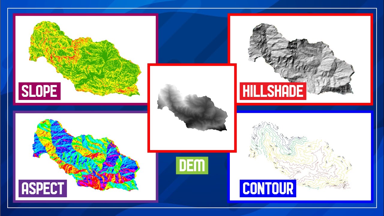
Slope || Aspect || Hillshade || Contour || Surface Analysis Using DEM Data In ArcGIS || #GeoFox
Показать описание
Hello Everyone, In this video, We will be using DEM Data to create a slope, aspect, hill shade, and contour. For this purpose, we will download STRM DEM from:
------------------------- My Other Videos ---------------------------------
Do watch my other videos:
How To Create A Contour Using DEM Data
How To Create A Covid-19 Map Using QGIS
Supervised Classification Using ArcGIS:
How To Create A Map With OSM Data Using QGIS:
How to Create A Choropleth Map Using Leaflet:
Create A Map Layer Using Leaflet:
Add A Marker To The Map Layer:
Use Different Map Tile Layer In Leaflet:
Add Google Map To Your Website:
Layer Group And Control In Leaflet:
Add Shapefile in leaflet:
How to add GeoJSON File in leaflet:
#Slope #Aspect #DEM #HillShade #SurfaceAnalysis #ArcGIS #ArcMap #GIS #Contour
Keywords: slope, aspect, dem, digital elevation model, hillshade, contour, arcgis, arcmap, gis
 0:08:33
Slope, Aspect, Contour , Hillshade Map in ArcGIS
 0:07:55
QGIS Terrain Analysis (Slope, Aspect, Hillshade, contour lines)
 0:03:40
DEM analysis: Slope Aspect Hillshade.
 0:10:09
Slope || Aspect || Hillshade || Contour || Surface Analysis Using DEM Data In ArcGIS || #GeoFox
 0:04:12
QGIS Terrain Analysis: Hillshade, Slope, Aspect, Profile mapping I Generation of Contours
 0:14:02
Surface Modeling 1 (Slope, Aspect, Hillshade)
 0:09:55
Slope, Aspect, Contour, Hillshade in ArcGIS/ArcMap
 0:13:05
QGIS Terrain Analysis: hillshade, slope, aspect (Version 3.x)
 0:10:03
hillshade, slope, aspect from DEM (thanks to Qgis!!!)
 0:07:22
Deriving slope, aspect and hillshade
 0:15:37
Create Slope, Hillshade, Aspect & Contour Maps in ArcGIS Pro with DEM Data
 0:12:07
Creating Slope, Aspect and Hillshade Map in ArcGIS
 0:28:15
Slope, Hillshade, Aspect, curvature & elevation map From DEM in ArcGIS
 0:12:26
Creating Slope, Aspect, Contour, and Hillshade maps in ArcGIS
 0:24:32
ArcGIS: Hillshade, Slope, Aspect and Contour
 0:03:46
Slope, Aspect, Contour , Hillshade Map in ArcGIS 3d analysis , slope, aspect ,hill shade ,
 0:07:43
How To Show Slope, Aspect, Contour and Hillshade In ArcGIS.
 0:06:04
Generating slope, aspect, and hillshade layers from a DEM in QGIS
 0:05:57
Terrain Analysis (Slope, Aspect, Contour , Hillshade Map) using ArcGIS from DEM data
 0:00:15
Slope,Aspect,Contour,Hillshade in ArcGIS #GIStutorial #gistutorial @GIS Tutorial #satisfying
 0:02:58
Hillshade - Slope - Aspect : Spatial Analyst
 0:14:41
One Click ! Download DEM, Slope, Aspect, Hillshade & Roughness Data from OpenTopography | Free
 0:07:38
Hillshade, Slope and Aspect Analysis in QGIS
 0:07:46
How to make slope, aspect, and hillshade map in ArcGIS
Комментарии