filmov
tv
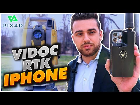
Pix4D - Introducing the viDoc RTK rover for iPhone and iPad

Показать описание
Introducing the viDoc RTK rover: an iPhone and iPad antenna case that allows for geolocated data collection. Partner this device with PIX4Dcatch to generate 3D models from your phone with accuracy down to 5 cm.
Available for selected iPhones and iPads.
TRY IT FOR YOURSELF:
#viDoc #RTK #PIX4Dcatch
Available for selected iPhones and iPads.
TRY IT FOR YOURSELF:
#viDoc #RTK #PIX4Dcatch
 0:01:10
Pix4D - Introducing the viDoc RTK rover for iPhone and iPad
 0:16:04
Pix4D viDoc RTK on iPhone vs Survey Total Station
 0:03:28
PIX4Dmatic Tutorial 1: Introduction to a PIX4Dmatic workflow
 0:01:23
Pix4D - 3D Capturing and Merging data with the PIX4Dcatch RTK Workflow
 0:04:53
Pix4D - New Video Tutorial - Capture a trench with PIX4Dcatch and a viDoc RTK rover
 0:03:36
This Handheld Device Can Scan Construction Sites
 0:12:17
viDoc RTK: a Surveying GNSS Receiver for your iPhone 14 Pro
 0:04:45
How to create a 3D fly-through video animation - Pix4Dmapper Video Tutorial 9
 0:06:06
Ultimate Pix4D tutorial 3D mapping
 0:01:41
PIX4Dmatic Tutorial 4: Process PIX4Dcatch data with PIX4Dmatic
 0:00:57
Pix4D - Document your trench with PIX4Dcatch and an RTK rover ( for iPhone )
 0:19:46
Combining Drone Data with iPhone Data
 0:05:13
Pix4D - Product Overview 2020
 0:00:57
Pix4D - Measure your stockpile with PIX4Dcatch and an RTK rover ( for iPhone & Android )
 0:02:00
Pix4Dcloud: The online platform for drone mapping, progress tracking, and site documentation
 0:05:02
Pix4D - Video Tutorial - Create a project with Pix4Dcloud Advanced
 0:04:50
PIX4Dfields - How to map your crop in minutes (in-field tutorial)
 0:11:57
Pix4D Introduction - Vectors EDU Tutorial
 0:03:24
Pix4D - Video Tutorial - Organize sites, datasets, and folders with Pix4Dcloud Advanced
 0:07:48
Creating and processing a project | PIX4Dfields Beginner Tutorials
 0:00:55
Pix4D - PIX4Dmatic feature: Project Merging
 0:09:25
More accurate maps and 3D models with tie points: Pix4Dmapper Video Tutorial 4
 0:13:02
Smartphone Mapping with iPhone LiDAR & viDoc RTK
 0:06:04
Automatic DTM generation and Contour Lines - Pix4Dmapper Video Tutorial 13
Комментарии