filmov
tv
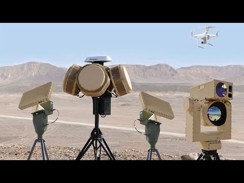
UAV Navigation | Automatic Geofencing Actions In No-Fly Zones

Показать описание
Geofencing can be defined as the creation of virtual perimeter fences around geographical areas or points of interest to designate them as special areas to keep them safe before possible risks and leave them free of aerial traffic.
The growing use of drones by the general public has popularized this term after a series of unfortunate events in zones close to aerodromes where the presence of a 3D perimeter in a defined distance and height/altitude could have prevented unauthorized drone operations from violating controlled or restricted airspaces.
This increase of the risk has led the European Commission to establish a harmonized regulation frame called U-Space. One of the first draft amendments published said that the U-Space system required three elements to put it in place: namely registration, geofencing, and electronic identification.
At any flight, operators must appoint potential hot zones or non-authorised zones to ensure the aircraft do not enter restricted flight areas during the flight, for example, populated areas. For this reason, geofencing technology is expected to play a greater role for UAS of many types, sizes, and capabilities.
UAV Navigation is concerned with the evolution of the industry and the current requirements of the regulation, so we develop our flight control solutions to assure their correct operation and prepare them for future integration with manned aviation.
The new geofencing capabilities of the UAV Navigation’s autopilots allow it to perform automatic actions once the UAV is going to invade a predefined No Fly Zone. This way, the autopilot will be able to know when it will cross a boundary and execute autonomous actions to not invade these areas.
Our GCS software includes a No Fly Zones editor to delimit restricted zones during the mission and store it in the autopilot memory as a collection of latitude and longitude points. Hence, in case of loss of communication, the autopilot will still be able to know where the not permitted zone is. Visionair, UAV Navigation’s GCS software, allows users to intuitively edit polygonal and circular areas where the aircraft can navigate either internally or externally. Additionally, the No Fly Zone editor includes a tool the operator can use to configure automatic actions when detecting the zone.
The aircraft will perform defined events such as changing to Hover mode (for rotary wing platforms) or emergency actions like parachute deploy, preventing unsafe situations with other platforms, buildings or structures.
The main commitment and concern of UAV Navigation is to ensure flight safety and make unmanned aviation integration with manned air traffic become a reality. This will help to extend the use of UAS in providing important services to humanity.
If you want to work with a trusted and reliable system and provide your platforms with the possibility to fly in controlled airspace, contact us.
 0:00:50
 0:01:51
 0:01:04
 0:01:01
 0:01:00
 0:01:45
 0:01:13
 0:00:58
 0:00:36
 0:00:46
 0:15:13
 0:00:57
 0:03:29
 0:01:17
 0:00:38
 0:02:28
 0:02:47
 0:02:21
 0:11:20
 0:01:52
 0:13:58
 0:00:44
 0:01:40
 0:01:17