filmov
tv
Install ArcGIS Editor for Open Street Map

Показать описание
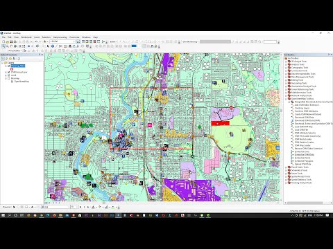
The ArcGIS Editor for OpenStreetMap allows you to use ArcGIS tools for working with OpenStreetMap data. There are two setups in this download. One is compatible with ArcGIS 10.4.x, the other compatible with ArcGIS 10.4 with the 64 Bit Background Geoprocessing installed additionally; i.e., it is in the "ArcGISEditor10_4_x64" folder. After installing, launch ArcMap and you should see an 'OpenStreetMap Toolbox' installed under your system toolboxes in the catalog browse window. See documentation for how to use the tools.
Step 1- Download OSM editor
Step 2- Check your ArcGIS Bit version
Step- 3 Install OSM editor
Step-4 Launch ArcMap
Link
**************************************************************************************************
Workshop Alert on An Integrated MCDM approach for Drought Vulnerability Assessment in ArcGIS
**************************************************************************************************
Enrollment link
*******************************************************************************************************
UDEMY Course
Rainfall Indices for MCDM models in ArcGIS: how and Why?
Preparation of 10 important rainfall indices for MCDM models and time series analysis using Excel, ArcGIS and QGIS
Click this link only Rs. 390 or 12.99 USD
*******************************************************************************************************
Advances in Geographical Research
Learn research methodology online with courses of Advanced Geospatial technologies, statistical methods, and Machine Learning algorithms.
*******************************************************************************************************
WhatsApp Group for subscribers:
Group 1
Group 2
***************************************************************************************
Playlist
1. Basics Remote sensing
2. MCDM and ML
3. Arc GIS
4. Free online data download
5. Advanced Excel
SUBSCRIBE to the YouTube channel Dr. Jayanta Das, to get notification about our recent lecture uploads on Advances in Geographical Research.
ALL RIGHTS RESERVED.
#DrJayantaDas
 0:03:01
How to Install Arcgis Editor for Open Street Map (OSM)
 0:02:27
Install ArcGIS Editor for Open Street Map
 0:02:22
Install ArcGIS Editor for OpenStreetMap
 0:04:55
How to download and install ArcGIS Editor for Open Street Map
 0:00:52
ArcGIS Editor for OpenStreetMap
 0:03:11
How to Download Open Street Maps| OSM Data| ArcGIS| ArcMap 10.8 Version
 0:05:55
import OSM file into ArcGIS
 0:01:26
GIS: Installing ArcGIS Editor 10.2 for OSM?
 0:03:53
How to Import Shapefiles | ArcGIS Tutorial
 0:09:27
Using OpenStreetMap Data in ArcGIS for Education
 0:22:35
OpenStreetMap and ArcGIS: Mapping the Future
 0:06:33
Uploading Shapefiles to ArcGIS Online
 0:01:47
GIS: ArcGIS - Editor toolbar not opening
 0:10:02
Downloading OSM data files | Openstreetmap data in GIS
 0:08:40
Download OSM Data File Openstreetmap Data Di ArcGIS (Shapefile) Detail
 0:04:40
how to download open street map and open in ArcGis|How to open street map data in arcgis
 0:05:24
How to add directly Google Maps/Satellite Map/Google Earth in ArcGIS
 0:02:00
GIS: Why is toolbox of ArcGIS Editor for OpenStreetMap not in ArcToolbox? (2 Solutions!!)
 0:00:34
Senior Programmers vs Junior Developers #shorts
 0:00:58
Customize the Quick Access Toolbar in ArcGIS Pro
 0:04:56
Blender GIS
 0:00:55
How to find editor in ArcGIS ?
 0:07:48
ArcGIS | open street map tutorial
 0:01:37
ArcGIS Enable Editor Tracking (in ArcCatalog)
Комментарии