filmov
tv
Calculating Water indices using ENVI and Landsat 8 Images (NDVI, NDWI, WRI, AWEI)

Показать описание
Water indices are the topic of this video. At the end of the video, you'll be able to apply any water index to your images.
Accurate and frequent updates of surface water have been made possible by remote sensing technology. Index methods are mostly used for surface water estimation which separates the water from the background based on a threshold value. An index is generated by combining data from multiple spectral bands into a single value using Usually simple algebraic formulations.
in this video, not only do we show you the needed Pre-processing, but we also apply NDVI, NDWI, WRI, and AWEI (sh - nsh) indices on Landsat 8 images in the ENVI software.
___________________________________________
Subscribe to our channel and Like the video:
_ _ _ _ _ _ _ _ _ _ _ _ _ _ _ _ _ _ _ _ _ _
Share the video with others:
=========================================================
Timeline:
00:00 - Introduction
00:33 - Landsat 8 Image
01:28 - Radiometric Calibration
02:14 - Atmospheric Correction
02:58 - Surface Reflectance
04:45 - Water Index
04:58 - NDVI
05:41 - NDWI
06:35 - WRI
07:28 - AWEI no shadow
09:17 - AWEI Shadow
=========================================================
Calculating Water indices using ENVI and Landsat 8 Images (NDVI, NDWI, WRI, AWEI)
#rsandgis #gis #arcgistutorial #ENVI #Water #Water_index #Landsat #NDVI #NDWI #WRI #AWEI RS&GIS
 0:11:41
Calculating Water indices using ENVI and Landsat 8 Images (NDVI, NDWI, WRI, AWEI)
 0:21:26
Compute various indices using Envi
 0:06:03
Calculating NDWI unsing ENVI Sotware
 0:10:14
Calculating Vegetation Indices using ENVI and Landsat 8 Images (NDVI, RVI, EVI, SAVI)
 0:07:28
Calculate NDVI by using ENVI 5.3
 0:07:15
Calculate NDVI using ENVI Software
 0:08:29
Spectral indices tool in ENVI - All-in-one tool ( Vegetation, Water, Built-up, Burned area, etc.)
 0:11:43
Calculate NDVI from Landsat 8 using ENVI Software
 0:08:45
Delineate water area using NDVI, NDWI, MNDWI in ENVI
 0:05:56
SPECTRAL INDICES, ENVI, ndsi
 0:11:45
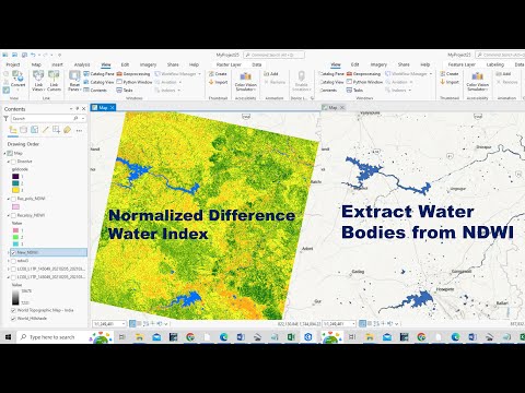
How to Prepare Normalized Difference Water Index (NDWI) and Extract Water Bodies from NDWI
 0:13:20
Compare various indices using ENVI
 0:15:34
Separate water surface from non water surface areas by creating MNDWI (ENVI part5)
 0:03:22
NDWI | How to calculate Normalize Difference Water Index in ArcGIS
 0:08:21
Calculating NDVI (Normalized vegetation Index) using Landsat8 images in ENVI 5.3
 0:05:06
ENVI Software Claculating Normalized Difference Built Index NDBI
 0:57:55
Mastering ENVI and Landsat 8 Image Analysis: A Step-by-Step Beginner's Tutorial
 0:05:07
Calculate Normalized Difference Water Index | Erdas Spatial Modeler | Remote Sensing Tutorial
 0:05:35
Comment calculer le NDWI sur le logiciel ENVI - Calcul d'indice spectral
 0:21:46
Band math and spectral indices in ENVI
 0:21:45
Tsunami Change Detection Analysis in ENVI 5.6
 0:08:57
How to do Normalized Difference Vegetation Index (NDVI) in Envi
 0:07:01
Spectral signature of water by ENVI 4.7
 0:09:38
Water Count or Area Calculation from Landsat 8 Imagery using Arc GIS Software by NDWI Technique
Комментарии