filmov
tv
Drone LiDAR vs Photogrammetry | Epic Stadium 3D model

Показать описание
We need to create a 3D model of this football stadium! See how a LiDAR Drone and DJI Inspire 2 Photogrammetry mission compare on capturing the FULL 3D model of the Stadium.
 0:11:02
Drone LiDAR vs Photogrammetry | Epic Stadium 3D model
 0:15:17
Photogrammetry VS LiDAR - Which Is BETTER?
 0:03:15
Photogrammetry vs LiDAR - Which Should You Use for Drone Mapping?
 0:06:39
DJI Zenmuse L1 v/s DJI Zenmuse P1 - LiDAR v/s Photogrammetry - What's the best?
 0:02:25
Photogrammetry vs LIDAR Overview
 0:03:21
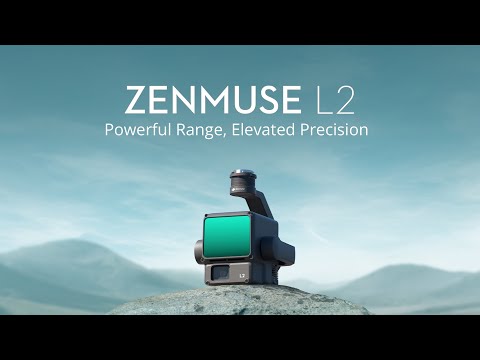
This is DJI Zenmuse L2
 0:06:57
Photogrammetry VS LiDAR
 0:00:13
DJI Matrice 4E in Action: Mapping Like Never Before 📹 @skydeploy
 0:00:25
'Matrice 300' Fotogrametría vs Lidar #drone #fotogrametria #dji #lidar #matrice300rtk #pas...
 0:11:31
What is LiDAR Drone Surveying | Accuracies and Results
 0:17:42
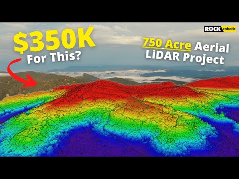
What Does A $350K LiDAR Project REALLY Look Like?
 0:04:23
Drone LIDAR Training Series Video-1 || LIDAR VS PHOTOGRAMMETRY || droneschools.in
 0:56:17
LiDAR vs Photogrammetry with Skydio 3D Scan
 0:04:42
Drone LIDAR Training Series English Video-1 || LIDAR VS PHOTOGRAMMETRY || droneschools.in
 0:03:04
Drone LIDAR + Photogrammetry : True View 3D Imaging Sensors
 0:17:24
What is Survey grade accuracy? | Drone Photogrammetry Mapping & Lidar Deep Dive
 0:00:17
Dji Matrice 600pro cinematic shorts #drone #photogrammetry #dronesurvey #makeinindia #lidar
 0:12:54
Are RTK Drones worth it?
 0:53:35
Photogrammetry vs Lidar - A primer
 0:11:46
DJI Mavic 4 Pro For Photogrammetry and 3D Modeling Review
 0:03:59
LiDAR Laser Scanning vs. Photogrammetry | Key Differences Explained!
 0:00:16
Crazy 3D Forest LiDAR Capture with ROCK R3 Pro | #Shorts #ROCKRobotic #Forestry #Environment
 0:01:00
#1 MUST HAVE Drone Surveying Tool 🧰 #drone #gnss #survey
 0:10:23
03 Photogrammetry, Thermal and LiDAR - Drone Industrial Solutions
Комментарии