filmov
tv
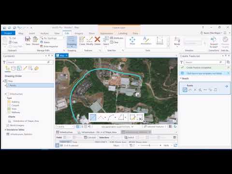
Creating Road Polygons from Lines - Using the Buffer Tool in ArcGIS Pro

Показать описание
When is a line not a line? When it turns into a polygon! This question is all about scale. At a national level, roads are always line features, but if you are mapping at the scale of an individual school for example, roads can be mapped as polygons. However lines are easier to digitise! So here we use a line feature and the buffer tool to convert our road centrelines into polygons. It's a bit of a cheat, but works well if you don't need to have 100% precision or accuracy. Otherwise you probably should just go the slow route and digitise the full polygon :)
 0:09:33
Creating Road Polygons from Lines - Using the Buffer Tool in ArcGIS Pro
 0:16:43
Generating Road Polygons from Lines - Utilizing Buffer Tool in ArcGIS Pro
 0:08:41
Creating Road Polygons in ArcGIS Pro2.6
 0:07:54
How to create road polygons from lines with Looper API
 0:06:47
arcGISpro buffer on polygons and lines
 0:10:38
ArcGIS Tutorial: How to create polygons, lines, and point features
 0:06:57
Construct Polygons from Lines ArcGIS Pro
 0:02:17
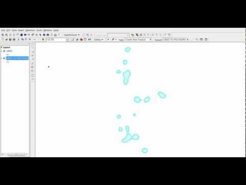
QGIS: Lines To Polygons
 0:03:34
ArcMap Convert Polylines to Polygons, Two easy methods
 0:08:42
Creating and Editing Lines and Polygons in ArcMap
 0:04:00
Convert lines to polygons in ArcMap
 0:18:50
How to edit in ArcGIS Pro and ArcMap
 0:10:38
Digitization in QGIS || Digitization in point, line and Polygon in QGIS || IT GIS || QGIS
 0:01:27
Creating polygons, lines or point shapefiles in ArcCatalog 10.2 - 1
 0:04:00
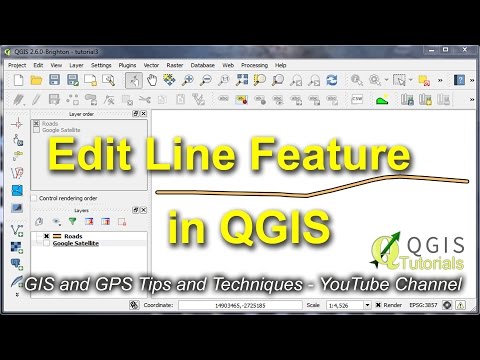
Edit Line or Polygon Feature in QGIS
 0:10:59
Creating Buffers for Points, Lines, and Polygons in ArcGIS Pro
 0:03:59
Lines to Polygons QGIS | How to Convert Lines to Polygons using QGIS
 0:04:38
Creating a new shapefile or geodatabase feature class in ArcGIS Pro
 0:03:11
GIS: Creating polygons of area surrounded by roads / lines using PostGIS? (3 Solutions!!)
 0:13:20
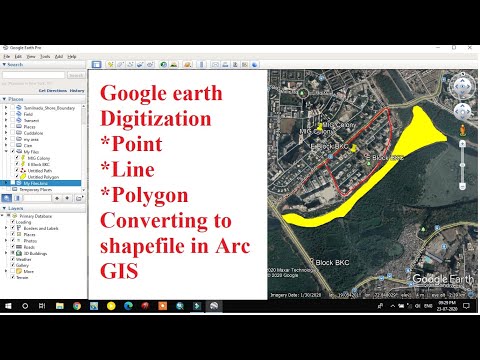
Digitization in Google Earth/ Point-Line-Polygon digitization in google Earth/ KML to Shapefile
 0:17:46
Extracting Raster Values using Points, Polygons & Lines | QGIS
 0:03:29
How to Speed Up Drawing Polygons in ArcMap 10.8
 0:05:52
QGIS Create Shapefile || Shapefile Layer in QGIS
 0:16:23
Master the Digitizing in 15 Minutes | ArcGIS In-Depth Tutorial
Комментарии