filmov
tv
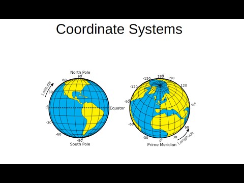
QGIS Basics - Coordinate reference systems (CRS) in QGIS

Показать описание
QGIS Basics - Coordinate reference systems (CRS) and specifically the British National Grid in QGIS.
If you are following along with the shape files as a WECS student, be sure to copy ALL the shape files across to your folder as described on Brightspace.
If you are following along with the shape files as a WECS student, be sure to copy ALL the shape files across to your folder as described on Brightspace.
 0:04:56
QGIS Basics - Coordinate reference systems (CRS) in QGIS
 0:10:16
A short guide to QGIS 3 Coordinate Reference Systems (CRS)
 0:10:40
Working with Coordinate Reference Systems in QGIS
 0:08:07
QGIS Coordinate Reference Systems (CRS) and Projections
 1:12:30
QGIS for beginners: Coordinate Reference Systems with Gavin Fleming
 0:09:36
Coordinate reference system in QGIS and GRASSGIS
 0:05:17
QGIS Basic Coordinate Systems
 0:01:44
Set CRS (coordinate reference system) in QGIS
 0:10:55
QGIS 2 Lesson 1 - Coordinate Reference Systems Part 1
 0:06:17
QGIS Beginner Part 1: Making Your First Map
 0:09:43
GIS Coordinate Reference Systems
 0:03:43
How to convert a layer CRS coordinate reference system in QGIS
 0:06:54
QGIS Course 2 Lesson 4 - Coordinate Reference Systems Part 2 Distortions in coordinates sytems
 0:16:38
QGIS Basic #118: CRS Project and General Settings with 'on-the-fly' 3.10 vs 3.14
 0:04:50
Coordinate Systems in QGIS 3
 0:26:27
Tutorial 1 How to Reproject Coordinate Reference System (CRS) in QGIS
 0:05:52
How to change Coordinate Reference System (CRS) from a Shapefile in QGIS
 0:19:32
QGIS Course 2 Lesson 5 - Coordinate Reference Systems Part 3 - Geographic and projected coordinates
 0:05:41
(NO MUSIC) QGIS Basics #1: Create Layer and Add points
 0:03:40
QGIS Quick Tip - Projections
 0:11:35
QGIS Tutorial 4 Spatial Reference System
 0:04:21
QGIS Basics - Importing shape files and changing their CRS
 0:02:09
QGIS change project CRS (coordinate reference system)
 0:07:50
How to Create Point Layer and Add Points | QGIS Basics: 1
Комментарии