filmov
tv
Augmented Reality Sandbox

Показать описание
Data can be beautiful!
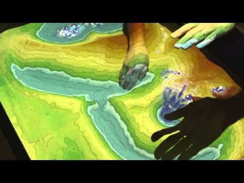
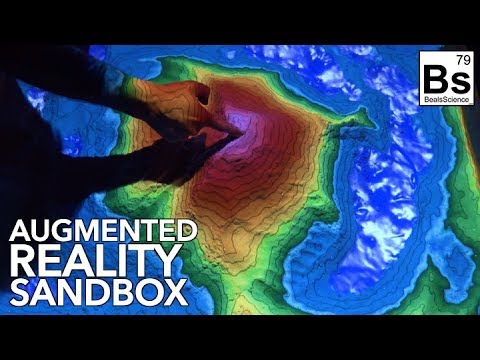
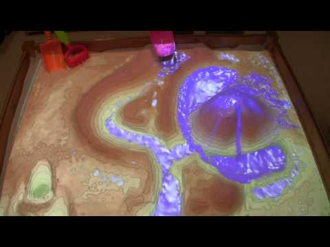
This interactive virtual topographic environment (and sandbox) is a fun way to engage with topographic mapping.
Using a stereoscopic camera to track sand height changes in real time, digital elevation values are color-coded and projected onto the map.
Designed as a final project for Geospatial Programming (GSP 318), you can play with it on the third floor of the HSU library.
 0:02:01
 0:04:29
 0:05:27
 0:01:00
 0:01:30
 0:00:48
 0:00:11
 0:04:51
 0:00:36
 0:05:27
 0:00:33
 0:00:12
 0:01:08
 0:01:19
 0:01:15
 0:00:24
 0:00:52
 0:01:08
 0:00:30
 0:05:46
 0:01:29
 0:00:36
 0:01:22