filmov
tv
Hydrographic Surveying

Показать описание
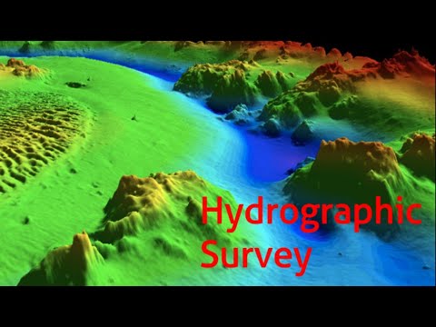
For projects situated below mean high water - such as dredging, harbor improvements, bulkheads/piers/docks construction, and environmental monitoring - it is necessary to know the depth of the sea floor. Coastal Engineering utilizes single beam sonar technology and RTK GPS systems to collect hydrographic survey data (soundings). The soundings are then processed and used to calculate proposed dredge and post-dredge volumes and generate bathymetric contour plots. Coastal Engineering also conducts routine hydrographic surveys to monitor seafloor depth changes caused by erosion and littoral transport of sediment over time. Other types of hydrographic surveys conducted by Coastal Engineering include eel grass surveys and tide gauge monitoring.
 0:07:01
 0:01:35
 0:18:58
 0:13:43
 0:14:53
 0:03:25
 0:02:36
 0:01:34
 0:26:15
 0:01:22
 0:01:41
 0:03:31
 0:03:02
 0:01:23
 0:00:46
 0:01:33
 0:03:04
 0:01:38
 0:01:10
 0:13:48
 0:04:59
 0:07:07
 0:00:38
 1:10:03