filmov
tv
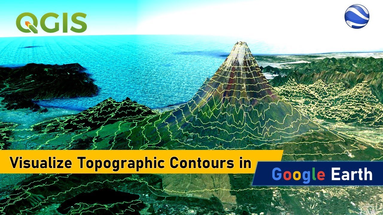
Visualizing Topographic Contours in Google Earth
Показать описание
In this tutorial, you will learn how to visualize topographic contours over a 3D terrain using Google Earth. We will be downloading the SRTM digital elevation data in raster format from USGS EarthExplorer web portal, and using QGIS we will generate the contour lines which is then exported to .kml file format.
We can use Google Earth application open the .kml file and visualize these contours on a 3D terrain.
You may also check out the following videos that are related to this tutorial:
#googleearth #3dmaps #geodeltalabs
We can use Google Earth application open the .kml file and visualize these contours on a 3D terrain.
You may also check out the following videos that are related to this tutorial:
#googleearth #3dmaps #geodeltalabs

Visualizing Topographic Contours in Google Earth

Visualizing Topographic Contours in Google Earth

Visualizing Contour (Topographic) Maps In Google Earth

extract contour lines from Google Earth

How to visualize topographical map in Google Earth | Overlay map on Google Eath

How to extract contour lines from Google Earth To Autocad

How to extract CONTOUR LINES from anywhere in the world!

Visualizing Landscapes From Topographic Maps

Visualization of Contour Maps with Augmented Reality

Using Google Maps to Visualize the Ridge & Valley

Create and Visualize Contour Lines in 3D using QGIS & Google Earth

How To Find Elevation On Google Maps | Tech Insider
Downloading Topographic Maps using Google Earth

3D Visualization of a contour map

How to view terrain in Google maps
Google Earth Timelapse: Urban Expansion Around The World

The easiest way to EXTRACT CONTOURS from GOOGLE EARTH directly in AUTO-CAD using GLOBAL MAPPER

Visualize Elevation With Google Earth Engine

Data Visualization using Google My Maps

Terrain visualization in Google Earth Engine #shorts

Visualizing Surfer 13 data in Google Earth

Visualizing Geographic Statistical Data with Google Maps

Drawing Contour Lines on a Topographic Map

How to use Google Maps to find contour lines on any map.
Комментарии