filmov
tv
10 PM Update: Tropical Storm Laura enters Gulf of Mexico; Marco downgraded to Tropical Depression

Показать описание
A tropical storm watch has been issued for the southeast Louisiana coast ahead of Laura. That includes lower Plaquemines, lower Jefferson, Lafourche and Terrebonne parishes. A hurricane watch is in effect farther west from Morgan City to southeast Texas.
Threats from Marco are pretty much finished - all warnings associated with Marco were canceled, although we could still get a breeze and some passing showers or storms from it Tuesday and a weak continuation of an onshore flow, keeping water levels a bit higher along the coast and in the tidal lakes.
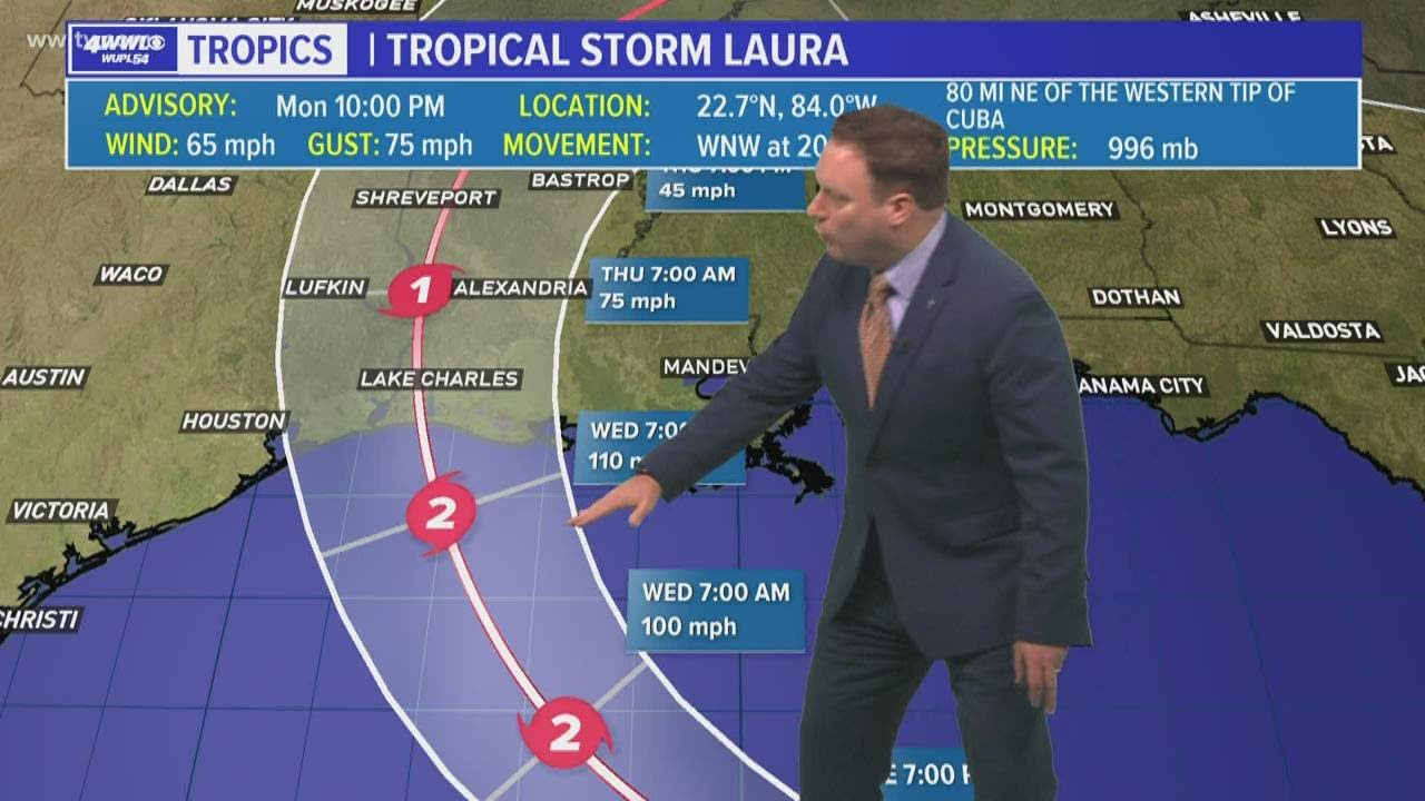
Our focus now shifts to Tropical Storm Laura, which is near western Cuba with winds of 60 mph. The forecast path hasn't changed much in the past day or so and takes it to southwest Louisiana by Wednesday night.
Tropical Storm Laura is currently located just west of the Cuban coastline and in the Gulf of Mexico. The storm is moving rather quickly to the west/northwest at 20 mph with winds of 65 mph at the Monday 10 pm advisory.
The forecast path hasn't changed much over the past day or so and takes it to southwest Louisiana by Wednesday night as a Category 2 hurricane.
Laura may be able to strengthen even more than that and could become a major hurricane (category 3 or higher). The overall atmospheric conditions in the Gulf of Mexico upon Laura's arrival could help it to rapidly intensify.
Impacts along the Gulf Coast will be possible starting late Tuesday night. That would include tropical storm force winds along the coast and breezy conditions farther inland for New Orleans and the Northshore.
New tropical storm and surge watches have been issued for southeast Louisiana ahead of Tropical Storm Laura.
Комментарии
 0:01:30
 0:01:54
 0:05:53
 0:02:57
 0:02:18
 0:05:50
 0:02:45
 0:04:08
 0:02:18
 0:01:07
 0:04:32
 0:05:13
 0:00:46
 0:06:51
 0:05:05
 0:01:32
 0:01:28
 0:05:54
 0:00:36
 0:00:51
 0:01:54
 0:02:19
 0:02:29
 0:01:10