filmov
tv
OpenCPN Basics - The FREE Chartplotter Program

Показать описание
Fellow boaters - I'm thrilled to share my latest project with you: MaintenanceROS! Crafted from my experiences aboard Starry Horizons, it's designed to simplify vessel and maintenance management, making life on the water even more enjoyable.
*****
OpenCPN is a FREE program you can use for planning sailing routes, or you can get more in-depth and use it as a complete chart plotter. It is incredibly powerful, and yes, completely FREE!
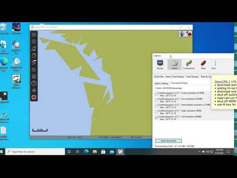
We use OpenCPN all the time aboard Starry Horizons so it was the logical choice to share with you in the first of our helpful programs/apps series. This video will cover where to download OpenCPN, how to install the program, some useful options to change, how to download (free!) navigational charts, setting up a GPS connection and a quick bonus segment talking about the feature we use most often.
These are just the basics, so if you’re interested for us to a deeper dive into the features and capabilities of OpenCPN, be sure and leave a comment below!
================
Table Of Contents
================
0:00 - Intro
0:33 - What Is OpenCPN?
1:48 - How To Download
2:46 - Resources: Manuals, Charts & Forum
5:15 - Installing OpenCPN
8:41 - Basic Setup Options
12:00 - Downloading Charts
19:35 - Setting Up a GPS Connection
23:50 - Bonus Tip: Measuring Distances
================
Related Links
================
================
Affiliate Links
================
*****
OpenCPN is a FREE program you can use for planning sailing routes, or you can get more in-depth and use it as a complete chart plotter. It is incredibly powerful, and yes, completely FREE!
We use OpenCPN all the time aboard Starry Horizons so it was the logical choice to share with you in the first of our helpful programs/apps series. This video will cover where to download OpenCPN, how to install the program, some useful options to change, how to download (free!) navigational charts, setting up a GPS connection and a quick bonus segment talking about the feature we use most often.
These are just the basics, so if you’re interested for us to a deeper dive into the features and capabilities of OpenCPN, be sure and leave a comment below!
================
Table Of Contents
================
0:00 - Intro
0:33 - What Is OpenCPN?
1:48 - How To Download
2:46 - Resources: Manuals, Charts & Forum
5:15 - Installing OpenCPN
8:41 - Basic Setup Options
12:00 - Downloading Charts
19:35 - Setting Up a GPS Connection
23:50 - Bonus Tip: Measuring Distances
================
Related Links
================
================
Affiliate Links
================
 0:26:36
OpenCPN Basics - The FREE Chartplotter Program
 0:12:14
How OpenCPN and SignalK Replaced Our Expensive Navigation Software
 0:37:07
How to Create Your Own Charts for OpenCPN: A Step-by-Step Guide
 0:06:55
OpenCPN Basics 1: M-key, Units, and Variation
 0:04:34
OpenPlotter - Charts install OpenCPN
 0:09:03
OpenCPN Basics 2: Help, Scales, Zoom, and Pan
 0:20:10
OpenCPN Part 2 - Basic Planning & Navigation
 0:07:26
OpenCPN Setup
 0:03:44
OpenCPN charts: 1. base maps
 0:01:59
Introduction to OpenCPN Part 1a
 0:00:51
OpenCPN on Android Tablet SAMSUNG GALAXY TAB S8
 0:17:54
Introduction to OpenCPN Part 1
 0:06:28
OpenCPN Charts: Quick Start, One Chart
 0:27:46
OpenCPN Installation & Basic operation tutorial - ECDIS sa PC or Laptop mo.
 0:09:13
OpenCPN Complete installation of Maps and GPS
 0:23:03
OpenCPN Plugins: My 5 Favorites
 0:23:30
OpenCPN 5.2 download and install
 0:03:21
OpenCPN, excerpt
 0:00:50
OpenCPN vs Simrad
 0:02:28
OpenCPN Charts: 0. Introduction
 0:22:33
OpenCpn installation tutorial part 1
 0:14:47
OpenCPN Chart Plotter
 0:07:16
Varen met OpenCPN, de kaarten van OpenSeaMap en de lagen van Openwaterkaart.nl
 0:01:25
openCPN Range Rings
Комментарии