filmov
tv
Major Hike Mt. Pigingan | 360° view | Agno river (PART 1)

Показать описание
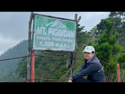
Mt. Pigingan is located in Brgy. Dalupirip, Itogon, Benguet. It has an elevation of 1328 meters or 4356 feet. Mt. Pigingan almost crosses the borders of Nueva Vizcaya and Benguet. Moreover, it's a 21-kilometer trek from the registration area to the summit and vice versa. Also, Mt. Pigingan is a more serious hike than Mt. Ulap. It's good for hikers looking for a more challenging day hike near Baguio.
Mt. Pigingan means slanted. Pigingan came from the local Ibaloi word "piging" which means "slanted". It was said that the mountain was named as such due to the descriptive outline of its peak. Although Mt. Pigingan is not a very popular mountain in the Cordillera Region and does not attain the grandeur of Mt. Pulag or Mt. Napulauan nor their high elevation, however, the trail offers a beautiful view of the scenic landscape of the Cordillera Region.
Undoubtedly, its neighbors Mt. Ulap and Mt. Ugo are already popular hiking destinations. On the other hand, Mt. Pigingan serves as an alternative to this hiking destination. Also, it's one of Benguet's hidden gems. At the same time, possibilities for a traverse to Mt. Ugo are possible for longer hiking adventures. Furthermore, the abundance of pine trees would still remind you that you are still in the Cordillera region, and the long trail is still a welcome challenge for hikers looking for a more serious day hike in Benguet province.
#dalupiriphangingbridge #mtugo #mtulap #baguio #majorhike #akyatbundok #baguiocity #clearing #bagyongkarding #travelph #mountainsofthephilippines #dayhike #travelvlog #daytour #insta360
Follow my socials:
Check out Smiles for Miles Travel Tours
Travel Organizer/Coordinator
Please subscribe to Sir Jersam
Camera:
Insta360 Go 2
Insta360 One X2
Music:
This Is It - Oh The Larceny
Mountains - Will Pearce Topic
Love Tonight (David Guetta Extended)Mt pigingan summitPigingan ridgeagno riveritogonitogon benguet
 0:18:24
 0:06:18
 0:05:25
 0:05:03
 0:25:54
 0:06:38
 0:06:36
 0:12:47
 0:18:54
 0:13:33
 0:03:35
 0:01:24
 0:12:17
 0:28:56
 0:05:25
 0:10:27
 0:06:09
 0:13:30
 0:13:10
 0:04:18
 0:05:31
 0:02:53
 0:03:17
![Mt. Pigingan [4-15-18]](https://i.ytimg.com/vi/Cu4IjpFC8l0/hqdefault.jpg) 0:03:17
0:03:17