filmov
tv
GIS and Drone Technology Solving Infrastructure Problems

Показать описание
Justin Guerra is an experienced GIS and drone program manager currently serving at the Texas Rural Water Association. After completing his civil service as a United States Marine, Guerra leveraged his military precision and discipline into a career enhancing infrastructure problem-solving.
With a rich background that includes military deployment to Afghanistan and humanitarian missions in Africa, he possesses a unique global perspective on the importance of resources like water.
His academic journey in geography and his hands-on approach to rural utility systems have made him an expert in GIS application and implementation, significantly assisting rural communities to elevate their standards to those of larger municipalities.
Key Takeaways:
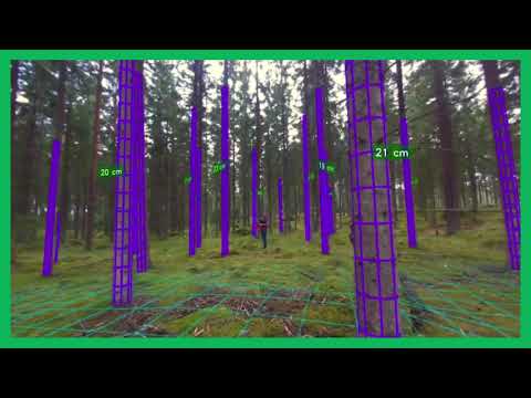
GIS and drone technology streamline water system management and safety inspections, making them more efficient and less risky.
Operators hold crucial knowledge about utility systems; involving them in the data collection and decision-making process leads to more accurate infrastructure mapping.
The resistance to adopting GIS technology often stems from concerns over job security among traditional utility workers.
Sharing knowledge and data among utility services and within communities is pivotal for future-proofing water infrastructure.
Guerra's mission in GIS is not only about mapping but also enhancing the resilience and effectiveness of water systems for generations to come.
With a rich background that includes military deployment to Afghanistan and humanitarian missions in Africa, he possesses a unique global perspective on the importance of resources like water.
His academic journey in geography and his hands-on approach to rural utility systems have made him an expert in GIS application and implementation, significantly assisting rural communities to elevate their standards to those of larger municipalities.
Key Takeaways:
GIS and drone technology streamline water system management and safety inspections, making them more efficient and less risky.
Operators hold crucial knowledge about utility systems; involving them in the data collection and decision-making process leads to more accurate infrastructure mapping.
The resistance to adopting GIS technology often stems from concerns over job security among traditional utility workers.
Sharing knowledge and data among utility services and within communities is pivotal for future-proofing water infrastructure.
Guerra's mission in GIS is not only about mapping but also enhancing the resilience and effectiveness of water systems for generations to come.
 0:30:02
 0:32:17
 1:57:13
 0:02:43
 0:01:39
 0:11:31
 0:01:21
 0:03:11
 0:15:12
 0:45:13
 0:01:03
 0:06:53
 0:00:43
 0:00:14
 0:03:15
 0:00:40
 0:00:40
 1:01:19
 0:02:01
 0:23:25
 0:04:35
 0:00:14
 0:00:55
 0:04:09