filmov
tv
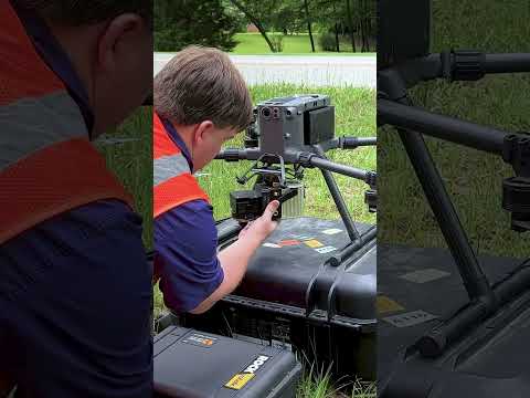
DJI M300 + ROCK R3 PRO Drone LiDAR #Shorts

Показать описание
Introducing ROCK R3 PRO from ROCK Robotic — The Best Just Got Better.
ROCK R3 PRO is the most accurate way to capture 3D data from the sky or on the ground.A groundbreaking Surveying tool to capture unprecedented, accurate 3D LiDAR and Photogrammetry data for Surveying, Mapping, Engineering, Mining, Powerline, Utility, BIM, Forestry and more.
#Drone #3DMapping #LiDAR #R3PRO #DroneLife #LandSurveying #LandSurveyor #CivilEngineering #Aerial #UAV #Mapping #SLAM #ROCKRobotic #DronePilot #DJI #M300 #Technology #shortsfeed #shortsvideo #youtubeshorts #youtube #indianadrones
 0:00:48
Introducing ROCK R3 PRO | ROCK Robotic
 0:00:18
DJI M300 + ROCK R3 PRO Drone LiDAR #Shorts
 0:00:59
Flying Drone LiDAR | ROCK R3 Pro x DJI M300 #shorts
 0:00:27
Flying a $30,000 dollar ROCK R3 PRO LiDAR on huge DJI M300 drone #dji #lidar #drone #shorts
 0:00:40
🚁 Fly-By Friday! Shark Fin Cove As Seen From A DJI M300 + ROCK R3 Pro LiDAR! 🌊✨
 0:00:49
Setting up the DJI M300 w/ ROCK R2A LiDAR
 0:03:12
How-To Install and Pre-Flight Drone LiDAR | R3 Pro
 0:17:08
How-To Fly Drone LiDAR | ROCK R3 Pro (Walkthrough)
 0:08:47
DJI L2 vs Inertial Labs RESEPI XT-32 vs Rock R3Pro LiDAR Comparison
 0:06:55
Mission Planning Drone LiDAR w/ DJI Pilot 2 (M300 & M350 | R3 Pro)
 0:00:14
Drone LiDAR with DJI M300 and ROCK Robotic R360 #drones #keepflying #lidar #surveying #shorts
 0:01:00
Unboxing The All-New ROCK R3 PRO #Shorts
 0:07:15
Worlds best (2023) Drone LiDAR works in a Cave
 0:00:39
Freefly Systems Drone x ROCK R3 Pro LiDAR #Shorts
 0:00:39
Setting up a Drone LiDAR #shorts
 0:00:09
DJI M300 - Hover UAV
 0:10:20
Bridge Inspection - LiDAR Drone Data review with DJI M300 and ROCK R2A
 0:12:29
Intro to Drone LiDAR Hardware (ROCK R3 Pro Specs)
 0:02:41
The Best 3D Mapping Scanner! (ROCK R3 Pro)
 0:18:06
How to fly a DJI Drone Terrain Following Mission with UgCS
 0:00:16
Impressive drone taking flight! #shorts #drone #lidar
 0:00:07
What LiDAR is on this DJI Drone?! #shorts
 0:02:37
DJI M300 Setting Up a Lidar Flight Mission for RESEPI Lidar System Hesai XT32 by Atlantic Laser ALSS
 0:01:00
#unboxing a $30,000 #drone camera #shorts
Комментарии