filmov
tv
GIS online training course «The use of GIS in animal disease response» [demo]
Показать описание
The online course «The use of GIS in animal disease response» is available in the e-learrning platform of the Istituto Zooprofilattico Sperimentale delle Venezie.
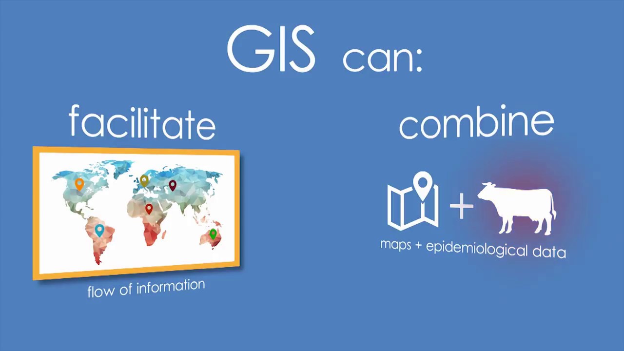
The course intended to present an empirical approach to implement a GIS project to capture, manage and analyse spatial data related to disease events. In particular, this course provides an introduction to QGIS (Quantum GIS, an Open Source GIS software for viewing, editing, and managing spatial data), a practical training on a specific QGIS plug-in.
The course is made up of 4 different modules, for a total estimated commitment of 10 hours. Modules 1, 2 and 3 include: video lectures, summaries, self assessment tests and an assignment, which can be useful to implement what you have just learnt. The last module contains interviews about practical methods for capturing spatial information related to farm location (learning outcomes are listed at the very beginning of each module).
The course is free of charge and endorsed by the World Organisation for Animal Health (OIE).
 0:03:42
 1:12:46
 0:00:11
![[FREE] Course Intro](https://i.ytimg.com/vi/NceRfn0SBIs/hqdefault.jpg) 0:01:48
0:01:48
 0:04:40
 0:04:52
 0:01:19
 0:15:12
 0:01:42
 0:04:05
 0:02:57
 0:07:13
 0:02:05
 0:02:36
 1:37:33
 0:21:42
 0:01:27
 0:00:57
 0:05:51
 0:00:25
 0:55:41
 0:03:28
 0:02:05
 0:00:23