filmov
tv
How to obtain a Basin and Channel Network from a No-sinks DEM in SAGA GIS and QGIS – Tutorial

Показать описание
A basin is defined as a topographic region in which all water drains to a common area. Identifying basins within a study area can be beneficial for land and water management because priority areas can be defined and the hydrology of the area can be visualized. Delimiting a basin can be done by using Geographic Information Systems such as QGIS and SAGA GIS. To do so, a Digital Elevation Model (DEM) is required since the drainage network is determined by the elevation and slope of the terrain. This tutorial demonstrates how to reproject a DEM raster in QGIS, how to fill the sinks of a DEM, to calculate flow accumulation, to obtain the channel network and the basin limits with SAGA GIS based on the DEM using the Upslope Area interactive tool.
 0:11:49
River, Basin, sub basin shapefiles for any area of the world
 0:14:57
Entering the Ancient Basin - Hollow Knight [Ep 36]
 0:02:09
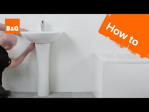
How to install a pedestal basin
 0:17:17
How to obtain a Basin and Channel Network from a No-sinks DEM in SAGA GIS and QGIS – Tutorial
 0:01:52
Throne and Liberty: How to Find Fonos Basin Treasure
 0:01:19
How to get out of Ancient Basin in Hollow Knight [using Dash and Wall Jump only]
 0:09:02
How to get to Ancient Basin in Hollow Knight
 0:06:38
4 MISTAKES CHANGING BASIN TAPS
 0:01:56
ELDEN RING: Path to Great Waterfall Basin via Ancestral Woods
 0:08:16
Step-by-Step Guide: Installing a Basin Mixer for Modern and Functional Bathroom Upgrade
 0:04:45
🔥Pet Catchers🔥Magma Basin Unlock Tutorial
 0:03:47
Glacial Basin Location | Subnautica Below Zero
 0:00:55
How to get out of Ancient Basin without Double Jump
 0:00:37
How to Use a BrassCraft® Basin Wrench
 0:02:39
Elden Ring Get to Great Waterfall Basin Site of Grace
 0:05:32
How to install a basin waste
 0:01:59
Elden Ring Get to Nokstella Waterfall Basin Site of Grace
 0:01:56
HOW TO FIND THE GLACIAL BASIN - EASY - SUBNAUTICA BELOW ZERO
 0:00:30
Use this to boost your Arathi Basin reputation in WoW Classic SoD! The Deflers Reputation hack
 0:13:01
HOW TO CHANGE OR REPLACE SINGLE BATHROOM BASIN TAP
 0:00:39
How to install basin faucet
 0:07:06
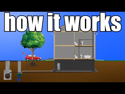
How Your Home Plumbing Works (From Start to Finish) | GOT2LEARN
 0:00:16
Basin Wrench - Faucet and Sink Installer 2021
 0:00:53
How to wash dishes sustainably in a “Single Basin” sink!🌟🌎💧🫧✨ #zerowaste #ecofriendly #plasticfree #...
Комментарии