filmov
tv
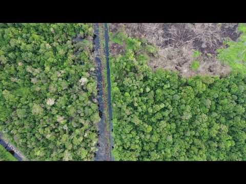
An Lurg drainage and exposed peat from drones

Показать описание
This video demonstrates CDMU's first attempt at mapping exposed peat and drainage channels from a drone survey. All of the data used in this model derives from a series of images taken during a single drone flight.
 0:01:08
 0:00:29
 0:00:16
 0:00:22
 0:03:48
 0:01:55
 0:00:20
 0:01:14
 0:03:15
 0:02:58
 0:12:16
 0:01:58
 0:02:39
 0:12:54
 0:02:11
 0:02:47
 0:17:17
 0:56:44
 0:02:28
 0:01:02
 0:36:58
 0:02:31
 0:11:01
 0:02:13