filmov
tv
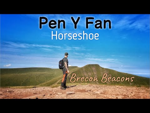
Pen y Fan Horseshoe Ridge Circular Walk | Brecon Beacons

Показать описание
The Horseshoe Ridge walk is probably my favourite walk in the Bannau Brycheiniog National Park. It's a challenging 10 mile circular walk that involves climbing the four peaks of Corn Du, Pen y Fan (the highest peak in southern Britain), Cribyn and Fan y Big. Pen Y Fan and Corn Du were also bronze age burial sites and each summit has a cairn on top, it has a mystical feel to it up there. Once on top of these summits you will have magnificent views stretching for miles in all directions.
You can start the Horseshoe Ridge from the Neuadd Car Park, Taf Fechan Forest (SO 036 169) For me this is the best place to start the walk, it offers you splendid views as you walk up Neuadd Valley and along the ridge above Graig Fan Ddu.
If you are planning on doing this walk, I would suggest that you wear good walking boots, and pack waterproofs and warm gear; the weather can be very unpredictable and can change quickly, even in the summer months. A map and compass should also be taken (OS map: Explorer OL12; Landranger 160).
I have added links below for the OS Maps App, Grid Reference OS, what maps you'll need, the route and Mountain Rescue.
Distance: 10 miles
Duration: 4 to 5 hours
Highest point: 2913ft
Route conditions: Well-worn pathways all around and stoned paths in places.
Difficulty: Challenging
#hiking #penyfan #walking
 0:21:05
Pen y Fan Horseshoe Ridge Circular Walk | Brecon Beacons
 0:08:14
Pen y Fan Horseshoe Ridge Walk - The Best Way to Experience South Wales' Highest Mountain!
 0:08:13
How to do the Pen y Fan Horseshoe Ridge Walk (Wales Best Hike?)
 0:01:20
Horseshoe Ridge Walk Circular - Brecon Beacons - Fan Y Big, Cribyn, Pen Y Fan & Corn Du
 0:11:13
Pen y Fan Horseshoe | A must-do hike in the Brecon Beacons National Park
 0:09:52
Hiking the full Pen Y Fan Horseshoe Ridge Walk | Brecon Beacons
 0:13:07
Pen Y Fan Horseshoe Ridge Walk, Brecon Beacons, Wales
 0:14:23
Pen Y Fan horseshoe ridge walk starting at Neuadd 9.3 miles Brecon Beacons
 0:15:02
Pen y Fan Horseshoe from Neuadd Reservoir Brecon Beacons South Wales UK
 0:10:42
Hiking Pen Y Fan & Brecon Beacons (horseshoe circular)
 0:00:14
Pen y Fan Horseshoe Walk in the Brecon Beacons
 0:11:22
A Complete Guide To The Pen y Fan Horseshoe - BEST walk in The Brecon Beacons
 0:05:15
Brecon Beacons Horseshoe Ridge Walk
 0:06:55
Hiking the Pen Y Fan Horseshoe - Brecon Beacons┋Wales Hike
 0:00:41
Horseshoe route Pen-Y-Fan
 0:07:21
Hiking the Pen-y-Fan Horseshoe Ridge Walk | Brecon Beacons | Hiking Vlog
 0:01:20
Horseshoe Ridge Walk - Brecon Beacons
 0:08:44
Hiking the Pen Y Fan Horseshoe Ridge - 11 miles.
 0:13:37
Pen Y Fan and the Beacons Horseshoe
 0:01:25
Pen y Fan - Horseshoe Ridge Walk
 0:02:48
The stunning Pen y Fan horseshoe ridge
 0:14:00
Hiking The Brecon Beacons Horseshoe Ridge - 4 Mountains in one loop! (Cribyn, Pen y Fan, Corn Du)
 0:01:00
Walking the Pen y Fan Horseshoe Ridge #hiking #breconbeacons #bannaubrycheiniog
 0:25:13
Brecon Beacons HIKE & WILD CAMP ABOVE THE CLOUDS Pen Y Fan Horseshoe
Комментарии