filmov
tv
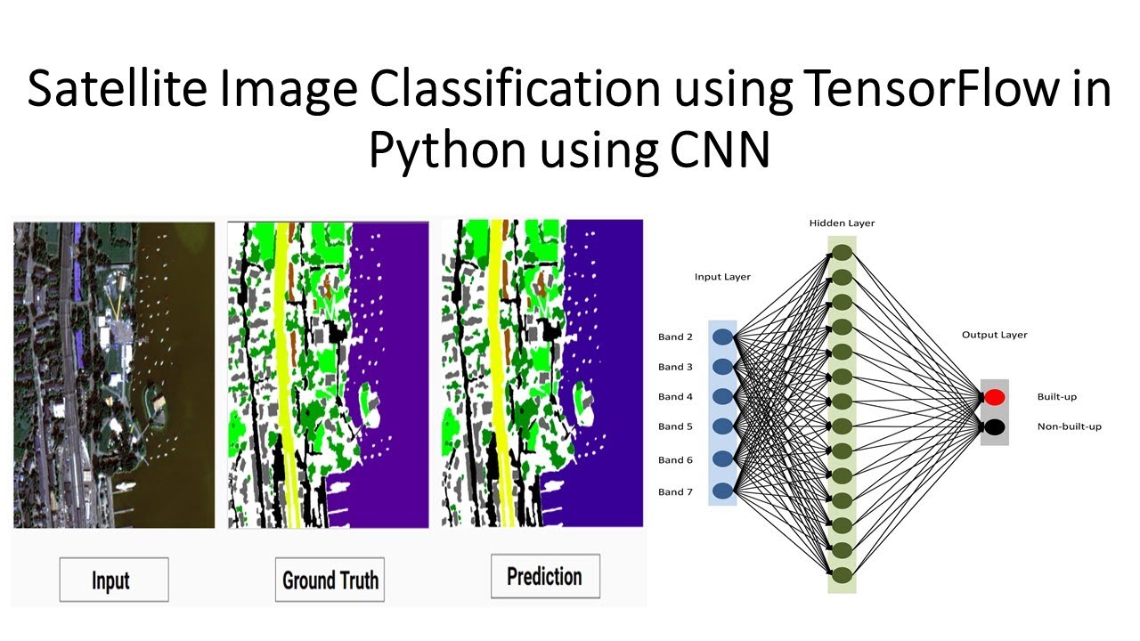
Satellite Image Classification using TensorFlow in Python using CNN
Показать описание
🌟 𝗥𝗘𝗚𝗜𝗦𝗧𝗥𝗔𝗧𝗜𝗢𝗡 𝗜𝗦 𝗡𝗢𝗪 𝗢𝗣𝗘𝗡 𝗳𝗼𝗿 𝟳 𝗗𝗮𝘆𝘀 𝗼𝗳 𝗖𝗼𝗺𝗽𝗹𝗲𝘁𝗲 𝗚𝗼𝗼𝗴𝗹𝗲 𝗘𝗮𝗿𝘁𝗵 𝗘𝗻𝗴𝗶𝗻𝗲 𝗢𝗻𝗹𝗶𝗻𝗲 𝗧𝗿𝗮𝗶𝗻𝗶𝗻𝗴! 🚀
📅 Class Start: 8th September 2023
⏳ Admission Last Date: 6th September
📅 Booking Last Date: 8th September (1st 10 registered people get a 50% discount. To get this discount as soon as possible complete your registration). Now only 5 seats are available to get this 50% discount. Hurry up!
🕖 Class Duration: 7 days (Friday and Saturday in Week), 3 hours each day, Time: 9:00 PM to 12:00 AM (GMT +6)
🗣 Language Mode: English
📚 Course Content:
1. Google Earth Engine: Introduction
2. JavaScript programming language A to Z
3. Google Earth Engine Server language A to Z
4. Filtering and Displaying Rater & Vector data
5. Importing Raster and Vector Data in GEE
6. Calculating with Images: Raster Calculations
7. Calculating NDVI, NDWI, EVI, & all indices.
8. Introduction to Image Classification in GEE
9. Landover & Land use classification Map using Machine learning
10. Crop land classification using Machine Learning
11. Exporting Raster and Vector Data from GEE
12. How to make research paper map using GEE & ArcMap software.
13. How to make a time-series chart for NDVI, NDWI, and other Indices?
14. Spectral indices and develop the skills for calculating any index (NDVI, NDWI, NDSI, MNDWI, MSAVI)
15. How to remove CLOUD Mask from satellite Images
16. How to monitor surface water rainy and Dry time periods
17. Visualization (DEM) of Hill shade, Aspect and Slope Map
18. How to make an NDVI chart over a period of time of an Agricultural Land
19. Air Quality Monitoring: atmospheric concentrations of ozone, methane, formaldehyde, aerosol, carbon monoxide, nitrogen oxide, and sulfur dioxide
20. How to Download Air Quality parameters Time series data in CSV format using GEE
21. How to make LULC accuracy assessment using Google Earth Engine. (Kappa, Producers & Consumers accuracy)
22. Monitoring Land Surface temperature using Landsat and Modis || Make Time series chart of LST
23. How to Calculate Average, Maximum & Minimum pixel values using GEE
24. How to calculate the Classified Area using Google Earth Engine
25. How to make single class Map such as Urban maps, Water body maps, etc.
26. How to ADD A LEGEND, Title in Google Earth Engine
📝 Online Training Benefits:
📜 eCourse Certificate (After submitting all Assignments)
📚 Materials (Slide, PDF)
💻 Practice Code (All codes provided)
📹 Recorded Class (All class recorded videos provided)
🎓 Lifetime teaching support
Don't miss this opportunity to enhance your Remote Sensing & GIS Analysis skills using Google Earth Engine. Join us now and unlock the power of geospatial data! 🌐🛰
#GoogleEarthEngine #RemoteSensing #GISAnalysis #OnlineTraining #GeospatialData #LearnGEE
 0:12:28
Satellite Image Classification using TensorFlow in Python using CNN
 0:08:46
Classifying satellite imagery - Made with TensorFlow.js
 0:00:28
Are you using IMAGE PATCHES for your DEEP LEARNING models?
 0:01:50
Landsat Classification Using Neural Network | Full Python Script for Free!!!
 0:01:00
Deep Learning tools in Building Detection from Drone & Satellite imagery
 0:31:59
Exploring Neural Networks for satellite image classification using Tensorflow in GEE - SERVIR Mekong
 0:05:52
Satellite image classification using tensorflow in python using cnn
 0:38:47
Land use land cover image classification using deep learning | EuroSat | ResNet50 | GeoDev
 0:08:19
Classification of Satellite Imagery With Deep Learning Model Using Google Earth Engine & TensorF...
 1:20:57
Deep learning Workshop for Satellite Imagery - Data Processing (Part 1/3)
 0:05:16
LULC Satellite Image Classification Using Deep Learning: How to Train a Deep Learning Model in Colab
 0:05:39
Satellite Imagery Deep Learning | Earth observation | Tensorflow | GeoDev
 1:25:05
Build a Deep CNN Image Classifier with ANY Images
 0:01:18
Satellite Image Processing Projects | Satellite Image Classification using Python
 0:31:19
Amazon Rainforest Satellite Image Classification using Convolutional Neural Networks
 0:13:37
Land Cover Classification using a Simple Deep Learning Model (TensorFlow) with Earth Engine Data
 0:18:29
Train Neural Network by loading your images |TensorFlow, CNN, Keras tutorial
 0:43:02
Satellite image classification
 0:00:55
Python Analysis of Satellite Imagery: 3 Easy Steps #Shorts
 0:07:23
LULC Satellite Image Classification Using Deep Learning: How to Prepare Dataset, Data Preparation
 0:02:32
Image classification vs Object detection vs Image Segmentation | Deep Learning Tutorial 28
 0:09:41
Land Cover Classification using Deep Learning Model using Tensorflow || Deep Learning for LULC
 0:00:31
YOLOv8 Comparison with Latest YOLO models
 0:00:21
Satellite Image Classification using Deep Learning | Object Detection using OpenCV Python
Комментарии