filmov
tv
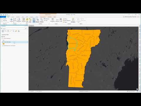
'Clip' GIS Geoprocessing Tool - The Core Vector GIS Toolkit (11)
Показать описание
Clipping is another vey routinely performed GIS geoprocessing task. It is often used to create a subset of dataset based on second datafile.
GeoMindz.com
geography
GIS
GISci
Geographic Information Systems
Geographic Information Science
Рекомендации по теме
0:17:53
'Clip' GIS Geoprocessing Tool - The Core Vector GIS Toolkit (11)
0:07:26
Use geoprocessing tools
0:01:21
How To Clip in ArcGIS Pro
0:13:52
ArcGIS Tutorial for Geoprocessing tools: (Create Buffers, Clip, Intersect, and Union, etc)
0:05:03
GIS vector overlay tools: clip, intersection, union, (symmetrical) difference
0:19:03
Geoprocessing tools in ArcGIS II Dissolve,Intersect, Union,Clip,Buffer
0:15:41
GIS Tutorial-02, Geoprocessing tools (Buffer, Clip, Intersect Union, merge, Dissolve, Identity)
0:01:29
how to clip a shapefile in arcGIS
0:13:45
TUTORIAL GEOPROCESSING (Clip, Merge, Dissolve, Union, Intersect, dan Buffer) Pada ArcGis
0:19:38
Clipping in QGIS - Vector Geoprocessing tools # Lesson 12 of 29 # QGIS Tutorial.
0:02:22
Geoprocessing: Clip
0:04:19
QGIS Tutorials 35: How to use Clip tool in QGIS | Beginners | QGIS 3.22 | Vector Clipping
0:03:16
How to clip features in ArcGIS
0:10:00
How to Buffer, Clip, Dissolve, Intersect, Merge and Union in ArcGIS || Geoprocessing Tools
0:02:44
Utah State University - GIS Lecture Series - Using the Clip Tool in Esri ArcGIS
0:06:16
ArcGIS Pro - Clip
0:10:04
How to do Batch Clip in GIS #geoinfonepal #iterate #Model Builder
0:02:14
GIS: Geoprocessing tools are not opening? (2 Solutions!!)
0:02:11
How to use clip tool in GIS | #TechwithFun
0:00:55
How to Use #Clip Tool in Arc #GIS | #2019 | Tutorial 30 | #TechwithFun
0:02:40
How To Clip Rasters in ArcGIS Pro
0:03:31
GIS: Geoprocessing Tools - I can't get Intersect/clip to work (4 Solutions!!)
0:05:33
The Erase GIS Geoprocessing Tool - The Core Vector GIS Toolkit (14)
0:09:48
Using Batch Clip in ArcGIS Pro

 0:17:53
 0:07:26
 0:01:21
 0:13:52
 0:05:03
 0:19:03
 0:15:41
 0:01:29
 0:13:45
 0:19:38
 0:02:22
 0:04:19
 0:03:16
 0:10:00
 0:02:44
 0:06:16
 0:10:04
 0:02:14
 0:02:11
 0:00:55
 0:02:40
 0:03:31
 0:05:33
 0:09:48