filmov
tv
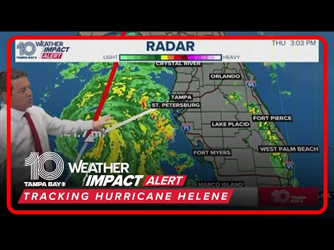
Hurricane Helene upgraded to Category 2 storm: Updates on its path

Показать описание
Hurricane Helene is now a Category 2 storm as it approaches the Florida with landfall expected later today.
(AP) Fast-moving Hurricane Helene was advancing Thursday across the Gulf of Mexico toward Florida, threatening an “unsurvivable” storm surge in northwestern parts of the state as well as damaging winds, rains and flash floods hundreds of miles inland across much of the southeastern U.S., forecasters said.
Helene was upgraded Thursday morning to a Category 2 storm and is expected to be a major hurricane — meaning a Category 3 or higher — when it makes landfall on Florida's northwestern coast Thursday evening. As of early Thursday, hurricane warnings and flash flood warnings extended far beyond the coast up into south-central Georgia. The governors of Florida, Georgia, and the Carolinas have all declared emergencies in their states.
The storm was expected to make landfall in the Big Bend region, where Florida’s panhandle and peninsula meet, according to Jack Beven, senior hurricane specialist at the National Hurricane Center in Miami.
“Regardless of how strong it is, it is a very large storm, Beven said. “It’s going to have impacts that cover a large area.”
The National Weather Service office in Tallahassee forecast storm surges of up to 20 feet (6 meters) and warned they could be particularly “catastrophic and unsurvivable” in Florida's Apalachee Bay. It added that high winds and heavy rains also posed risks.
“This forecast, if realized, is a nightmare surge scenario for Apalachee Bay,” the office said. “Please, please, please take any evacuation orders seriously!”
In Crawfordville, farther inland and about 25 miles (40 kilometers) northwest of Apalachee Bay, Christine Nazworth stocked up on bottled water, baked goods and premade meals at a Walmart. She said her family would be sheltering in place, despite Wakulla County issuing a mandatory evacuation order.
 0:01:00
Hurricane Helene upgraded to Category 4 ahead of landfall
 0:06:52
Hurricane Helene latest: Storm upgraded to Category 2 as it heads toward Florida
 0:00:48
Hurricane Helene upgraded to Category 4 storm
 0:04:07
Hurricane Helene upgraded to Category 2 storm: Updates on its path
 0:07:35
TRACKING HELENE: Hurricane upgraded to Category 3 before landfall | 3 p.m. Thursday
 0:07:29
Hurricane Helene strengthens to Category 4 | Special Report
 0:08:33
Tropics Update: Major Hurricane Helene a Category 4 storm at Florida landfall
 0:01:00
Hurricane Helene upgrades to Category 4 storm
 0:01:05
Hurricane Helene upgraded to Category 4 storm
 0:04:34
Helene upgraded to Category 3 hurricane
 0:03:56
Hurricane Helene upgraded to Category 3 storm | Update
 0:02:24
Helene upgraded to Category 2 hurricane as it barrels toward Florida
 0:03:28
Hurricane Helene: Strengthens to Cat. 3 storm as it nears Florida
 0:01:15
Video Now: Hurricane Helene upgraded to Category 2
 0:06:07
Tropics Update: Hurricane Helene strengthens into category 2 storm as it closes in on Florida
 0:06:13
Tropical Update: Hurricane Helene moves closer to Florida, Category 4 strength expected | 11 p.m. We
 0:01:58
Hurricane Helene: Now a Category 4 as it approaches landfall
 0:10:10
Category 4 Hurricane Helene nears Florida with 140 mph winds and deadly storm surge
 10:36:43
#BREAKING: HELENE UP TO CATEGORY 4 | Major Hurricane Reaches Tampa Bay, Q&A on Tracking the Trop...
 0:06:06
Hurricane Helene strengthens to a Category 4 storm as it makes landfall
 3:57:53
Hurricane Helene Updates LIVE: Florida Braces for Catastrophic Category 4 Storm Surge
 0:06:37
Hurricane Helene explodes to Category 4 hours from landfall
 0:06:41
Tracking Helene: Hurricane Helene upgraded to a Category 4 Hurricane
 0:07:53
Tropical update: Hurricane Helene | 8 p.m. Wednesday
Комментарии