filmov
tv
Somerset Levels Floods 2014 (Extreme Weather Case Study) | AQA GCSE 9-1 Geography

Показать описание
Case study of the Somerset Levels floods in 2014.
This is the eighteenth video for the AQA GCSE 9-1 Geography course, and the eighteenth video of the Challenge of Natural Hazards topic.
The Challenge of Natural Hazards Playlist:
Follow me on all platforms:
Do you have a video suggestion?
Video Script:
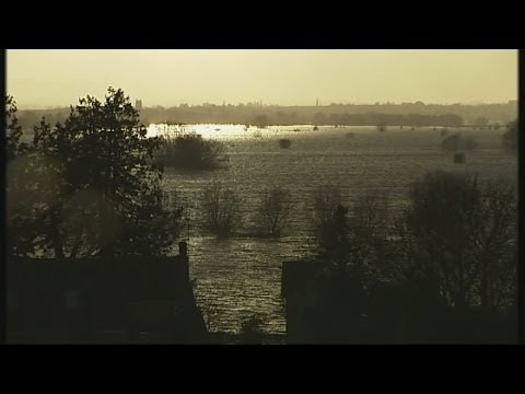
The Somerset Levels are an area of low-lying land and wetlands in south-west England. They are bordered by the Bristol Channel and Quantock Hills to the west and Mendip Hills to the north.
The area is drained by several rivers, including the River Tone and Parrett, which flow to the Severn Estuary via Bridgwater.
The floods occurred in January 2014 and were caused by the following:
» Heavy rain throughout winter - 350mm in January + February which is 100mm above the average.
» Rivers had not been dredged for at least 20 years.
» It was the wettest January since records began in 1910.
» A period of wet weather lasting several weeks was brought by a succession of depressions driven across the Atlantic Ocean.
» High tides and storm surges swept water up the Bristol Channel.
Social impacts
» Over 600 houses were flooded.
» 16 farms were evacuated.
» Residents were evacuated to temporary accommodation for several months.
» Villages such as Moorland and Muchelney were cut off.
» Many people had power supplies cut off.
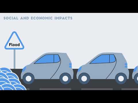
Economic impacts
» Somerset County Council estimated the cost of flood damage to be more than £10 million.
» Over 14,000 hectares of agricultural land was underwater for 3-4 weeks and over 1,000 livestock had to be evacuated, stopping farmers' income.
» Local roads were cut off by floods.
» The Bristol to Taunton railway line was closed at Bridgwater.
Environmental impacts
» Floodwaters were heavily contaminated with sewage, oil and chemicals.
» A huge amount of debris had to be cleared.
» Stagnant water that had collected for months had to be reoxygenated before being pumped back into the rivers.
Immediate responses:
» Rescue boats were deployed to help stranded people.
» Royal Marines were sent in to help with flood relief.
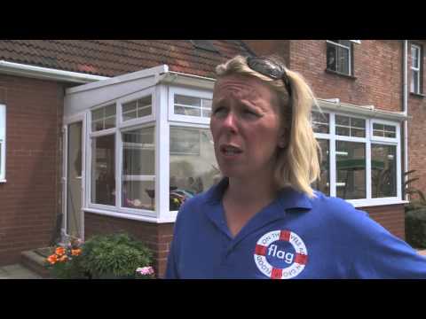
» Flooding on the Levels Action Group (FLAG) supported people in need of help.
Long-term responses:
» The UK government promised at least £30 million to help with repairs.
» £20 million Flood Action Plan launched by Somerset County Council.
» In March 2014, 8km of the Rivers Tone and Parrett were dredged to increase capacity.
» Road levels have been raised in places to maintain communications and enable businesses to continue during future flood events.
» Vulnerable communities will have flood defences.
» River banks are being raised and strengthened and more pumping stations will be built.
» By 2024, consideration will be given to a tidal barrage at Bridgwater.
--
GCSE Geography
30/04/2023
Keducate
This is the eighteenth video for the AQA GCSE 9-1 Geography course, and the eighteenth video of the Challenge of Natural Hazards topic.
The Challenge of Natural Hazards Playlist:
Follow me on all platforms:
Do you have a video suggestion?
Video Script:
The Somerset Levels are an area of low-lying land and wetlands in south-west England. They are bordered by the Bristol Channel and Quantock Hills to the west and Mendip Hills to the north.
The area is drained by several rivers, including the River Tone and Parrett, which flow to the Severn Estuary via Bridgwater.
The floods occurred in January 2014 and were caused by the following:
» Heavy rain throughout winter - 350mm in January + February which is 100mm above the average.
» Rivers had not been dredged for at least 20 years.
» It was the wettest January since records began in 1910.
» A period of wet weather lasting several weeks was brought by a succession of depressions driven across the Atlantic Ocean.
» High tides and storm surges swept water up the Bristol Channel.
Social impacts
» Over 600 houses were flooded.
» 16 farms were evacuated.
» Residents were evacuated to temporary accommodation for several months.
» Villages such as Moorland and Muchelney were cut off.
» Many people had power supplies cut off.
Economic impacts
» Somerset County Council estimated the cost of flood damage to be more than £10 million.
» Over 14,000 hectares of agricultural land was underwater for 3-4 weeks and over 1,000 livestock had to be evacuated, stopping farmers' income.
» Local roads were cut off by floods.
» The Bristol to Taunton railway line was closed at Bridgwater.
Environmental impacts
» Floodwaters were heavily contaminated with sewage, oil and chemicals.
» A huge amount of debris had to be cleared.
» Stagnant water that had collected for months had to be reoxygenated before being pumped back into the rivers.
Immediate responses:
» Rescue boats were deployed to help stranded people.
» Royal Marines were sent in to help with flood relief.
» Flooding on the Levels Action Group (FLAG) supported people in need of help.
Long-term responses:
» The UK government promised at least £30 million to help with repairs.
» £20 million Flood Action Plan launched by Somerset County Council.
» In March 2014, 8km of the Rivers Tone and Parrett were dredged to increase capacity.
» Road levels have been raised in places to maintain communications and enable businesses to continue during future flood events.
» Vulnerable communities will have flood defences.
» River banks are being raised and strengthened and more pumping stations will be built.
» By 2024, consideration will be given to a tidal barrage at Bridgwater.
--
GCSE Geography
30/04/2023
Keducate
 0:04:04
Somerset battles extreme flooding
 0:02:53
Somerset Levels Floods 2014 (Extreme Weather Case Study) | AQA GCSE 9-1 Geography
 0:05:56
Somerset Levels Flooding | AQA GCSE Geography | Weather Hazards 12
 0:03:47
Extreme Weather: The Somerset Floods
 0:06:29
The flooding of the Somerset levels 2014
 0:08:04
Somerset Levels Floods Jan - Feb 2014
 0:05:35
Somerset Levels flooded 2014
 0:05:16
Army poised to move into flooded Somerset
 0:04:46
(HD) Somerset Levels flooding from the A38. Fri 7th February 2014
 0:02:24
UK floods: Somerset flood zone - video
 0:07:08
Case study: Flooding on the Somerset Levels and Moors 2013/14
 0:16:27
Somerset Levels: Flood Crisis
 0:01:47
Some areas of Somerset flooded for the last 10 months
 0:01:13
Somerset Levels Flooding
 0:05:01
Somerset Levels still suffering under the floods
 0:10:02
Year 11 Lesson 14 The Somerset Level Floods, 2014 Video Instructions
 0:03:36
Aerial views show Somerset Levels four months after flooding
 0:01:32
Farmers battle floods on Somerset Levels
 0:04:14
Somerset Floods Relief 2014
 0:04:28
UK floods: anger in Somerset at 'damn people in London'
 0:01:23
Somerset flooding - from the air
 0:01:22
Floods in Somerset: Island house as owner builds makeshift flood barricade
 0:00:54
Flood Water Pumps Pumping into River Somerset Levels 2014
 0:12:14
Somerset Levels - A Case Study
Комментарии