filmov
tv
Topography Of The Mawrth Vallis Region Of Mars Captured By ESA’s Mars Express

Показать описание
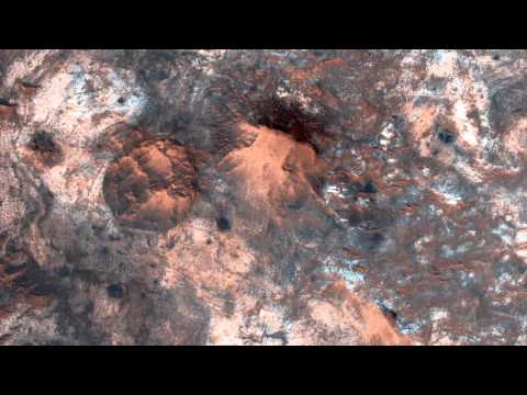
The Mawrth Vallis area of Mars is seen in this color-coded topographic picture. It was generated using data acquired by the European Space Agency's Mars Express on 18 February 2023 during orbit 24164. It is based on a digital terrain model of the region from which the landscape's topography may be determined. As indicated by the scale at the upper right, lower areas of the surface are displayed in blue tones, while higher altitude regions are shown in yellows and reds.
The direction of north is to the right. The picture has a ground resolution of around 18 m/pixel and is centred at roughly 25°N/339°E.
Credit: ESA/DLR/FU Berlin
The direction of north is to the right. The picture has a ground resolution of around 18 m/pixel and is centred at roughly 25°N/339°E.
Credit: ESA/DLR/FU Berlin
 0:00:14
 0:00:08
 0:01:01
 0:02:46
 0:01:01
 0:01:46
 0:00:33
 0:01:06
 0:04:00
 0:02:27
 0:01:07
 0:02:26
 0:02:36
 0:01:07
 0:01:24
 0:01:01
 0:03:09
 0:00:33
 0:01:03
 0:00:41
 0:24:19
 0:00:34
 0:04:02
 0:02:07