filmov
tv
Scale Factors and Point Clouds in TBC

Показать описание
This video explains the enhanced workflow to importing point cloud data (*.las, *.laz, and *.e57's) into TBC v5.30 and later. These improvements were made to assure that point clouds align with other survey data within your chosen coordinate system in TBC.
Available as shown in TBC v5.30 and later.
Available as shown in TBC v5.30 and later.
 0:11:37
Scale Factors and Point Clouds in TBC
 0:09:38
TBC v5.10 - LAS and LAZ Point Cloud Scale Factor Improvements
 0:04:48
Cadastral - Ground Scale Factor and Ground Distances in TBC v4.10
 0:04:27
Calculating Scale Factor and Applying Localization in TBC
 0:06:33
2 - Navigation - Point Cloud Viewer
 0:03:20
TBC-TRW Comparison 1 - Topographic Surveys with Point Clouds
 0:06:48
Relative V10 Adjustment Using Scale Information
 1:11:46
Working with Point Clouds
 0:09:36
Laser Scanning Explained: The Tools of Today and Technology of Tomorrow
 0:15:19
Scale Factors & COGO in Civil3D for Land Surveying
 0:05:38
TBC Tunneling - Remove Point Cloud Noise using Tunnel Automatic Classification
 0:01:15
Scale cloud native apps using the 12- and 15-factor methodology
 0:52:07
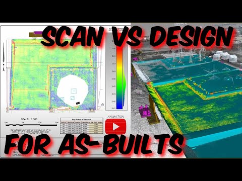
Creating As-built's Using Point Clouds
 0:16:29
How to cleanup Point Cloud Data in Trimble Business Center
 0:43:18
TBC and TRW: what's difference in point cloud processing?
 0:04:57
Scale factor
 0:07:26
TBC v5.10 - Point Feature Extraction Updates
 0:19:17
TBC v5.0 - Semi-Automatic Point Feature Extraction (In-Depth Demonstration)
 0:09:54
ReCap to Design Software — Preparing a Point Cloud for Modeling
 0:00:33
Лазерный сканер Trimble X7 & Trimble Perspective в Караганде Нуркен Абдиров...
 0:06:24
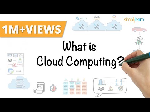
Cloud Computing In 6 Minutes | What Is Cloud Computing? | Cloud Computing Explained | Simplilearn
 0:06:41
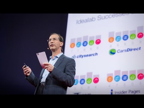
The single biggest reason why start-ups succeed | Bill Gross | TED
 0:52:21
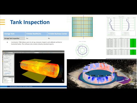
Webinar: Working with Point Clouds in Trimble Business Center TBC
 0:31:02
What's New in TBC v4.10?
Комментарии