filmov
tv
NASA | Satellites See Smoke Plume from Fourmile Canyon Fire

Показать описание
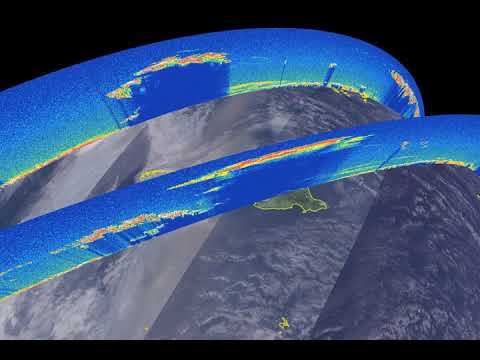
On the morning of September 6, 2010, a wildfire known as the Fourmile Canyon Fire broke out just west of Boulder, Colorado. The Moderate Resolution Imaging Spectroradiometer (MODIS) on NASA's Terra and Aqua satellites captured these images of the Fourmile Canyon Fire and its resulting smoke plume on September 7th and 8th. The red outline corresponds with the unusually high surface temperatures associated with an active fire.
To read more about this and other NASA satellite images of fires, visit:
Like our videos? Subscribe to NASA's Goddard Shorts HD podcast:
Or get tweeted by NASA:
Or find us on facebook:
To read more about this and other NASA satellite images of fires, visit:
Like our videos? Subscribe to NASA's Goddard Shorts HD podcast:
Or get tweeted by NASA:
Or find us on facebook:
 0:00:32
NASA | Satellites See Smoke Plume from Fourmile Canyon Fire
 0:00:32
NASA Satellites See Wildfires from Space
 0:00:33
NASA | Satellites See Smoke Plume from Fourmile Canyon Fire
 0:09:47
Finding Fires and Smoke Using Satellites (NASA Worldview) Tutorial #AirQuality #CitizenScience
 0:00:21
US wildfires seen from Nasa space satellite
 0:04:41
NASA Explorers S3 E1: Seeing Through Smoke
 0:00:32
NASA Satellites See Wildfires from Space
 0:13:02
Smoke and Fire From Space - Wildfire Images From NASA Satellites
 0:01:45
NASA using satellite tech to track wildfires and smoke from space
 0:00:32
NASA Satellites Detect Wildfires in Space
 0:00:33
NASA Satellites See Wildfires from Space
 0:03:02
NASA Satellites See Wildfires from Space
 0:04:37
NASA Explorers Ep 12 Seeing Through Smoke
 0:00:40
NASA’s CALIPSO Satellite Animation Shows Smoke From Australian Fires, Spreading High and Far East
 0:02:15
NASA and NOAA Take to the Air to Chase Smoke
 0:00:40
NASA’s CALIPSO Satellite Animation Shows Smoke from Australian Fires, Spreading High and Far East
 0:11:16
NASA Smoke Signals from Satellites
 0:04:41
NASA Explorers S3 E1 Seeing Through Smoke
 0:03:39
Why do some rocket launches look like this?
 0:00:48
Through Smoke and Fire, NASA Searches for Answers
 0:00:45
NASA releases pics of smoke from Amazon forest fires visible from space
 0:27:26
Smoke and Fire! NASA's Space Launch System Rocket Booster Test
 1:32:31
NASA ARSET: Smoke Modeling and Forecasting, Part 4/6
 0:00:09
Rocket Launch Cape Caneveral Nasa
Комментарии