filmov
tv
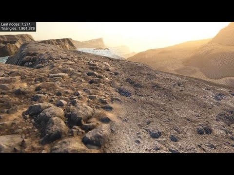
Terrain LOD Concept Test

Показать описание
Testing a static-geometry terrain with fixed level-of-detail which is attached to the camera [in c#]. It changes shape and uv-sampling based on camera position and orientation in world space to extract from a heightmap and the tiled texture-map (using wrapping). This removes need for culling or determining what's visible (as far as terrain is concerned). I got the idea for this when I was trying to figure out how geo-clip-mapping lod/terrain works.
(Note: I know this demo looks like garbage and jitters a lot - but this can be fixed with higher resolution mesh and higher resolution height-map [I'm only using 200x200 and 512x512 hmap and 128x128 texturing] - for testing -- should use much higher resolutions for all]
(Note: I know this demo looks like garbage and jitters a lot - but this can be fixed with higher resolution mesh and higher resolution height-map [I'm only using 200x200 and 512x512 hmap and 128x128 texturing] - for testing -- should use much higher resolutions for all]
 0:00:28
 0:03:15
 0:00:09
 0:00:25
 0:31:31
 0:01:15
 0:01:57
 0:00:30
 0:00:58
 0:00:31
 0:00:09
 0:00:40
 0:00:41
 0:09:46
 0:29:55
 0:00:34
 0:01:56
 0:01:40
 0:19:56
 0:01:41
 0:00:40
 0:01:05
 0:01:09