filmov
tv
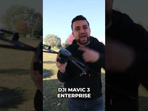
DJI Mavic 3E - 3D Modelling a RACETRACK!

Показать описание
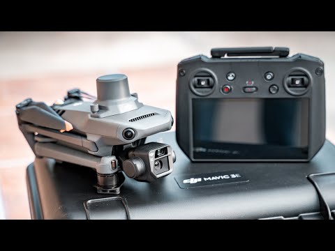
The all new Mavic 3E is a portable & powerful solution for enterprise needs such as 3D modelling, mapping, surveying, inspections, public safety and more. In today's video we'll take a look at a real-life scenario which will benefit from what the Mavic 3E is capable of - creating a 3D model of an old quarry that can potentially become a racetrack!
——————————————————————————————
——————————————————————————————
⬇️ ⬇️ ⬇️ GEAR I USE TO MAKE MY VIDEOS ⬇️ ⬇️ ⬇️
🚁 CAMERA DRONES 🚁
🥽 FPV GEAR 🥽
📸 CAMERA GEAR 📸
🌍 ACTION CAMS & 360 🌍
🖥 EDITING 🖥
Editing Software - Final Cut Pro X
💡LIGHTS💡
——————————————————————————————
🎶 MY CHOICE FOR MUSIC & SFX (AMAZING FOR CREATORS): 🎶
——————————————————————————————
The links you see in the description may or may not be affiliate links. This means if you click on them before you do your shopping I will get a small commission at no extra cost for you. This greatly helps me to continue creating more content for you and it’s massively appreciated! Thanks so much for your support, it means the world.
 0:09:46
DJI Mavic 3E Enterprise - Mapping and 3D Modeling Made Easy
 0:16:29
DJI Mavic 3 Enterprise - Mapping With DroneDeploy
 0:03:09
TechConnect | DJI Mavic 3 Enterprise Terrain Follow
 0:03:03
Introducing DJI Mavic 3 Multispectral
 0:03:43
DJI Mavic 3 Enterprise: Surveyor-Grade Mapping (Quick Review)
 0:00:40
DJI Mavic 3 Enterprise - RTK Surveying and Mapping Drone
 0:12:36
DJI Mavic 3E: Commercial Work Made Easy!
 0:09:33
DJI Mavic 3 Enterprise - RTK Surveying and Mapping Drone
 0:15:54
DJI MINI 3 || LITCHI PILOT BETA BUILD 520 FOR MINI 3/3 PRO
 0:08:12
RTK Attachment for the Mavic 3 Enterprise Series
 0:06:26
DJI Mavic 3 Enterprise RTK Review: Mapping Mission with Reach RS2 Setup - Part 1
 0:12:35
Mavic 3 Pro For Photogrammetry and 3D Modeling Review
 0:05:13
Smart 3D Mapping with DJI Mavic 4 Enterprise M4E – Full Tutorial & Field Demo
 0:05:24
DJI Mavic 3D Mapping Explanation with PIX4D (For Dummies ONLY)
 0:11:11
DJI Mavic 3E - 3D Modelling a RACETRACK!
 0:31:53
DJI Matrice 4 Enterprise In-Depth Review | Is It Worth The Upgrade?
 0:09:42
DJI Mavic 3 Enterprise Series: Mapping Mission
 0:04:18
Mavic 3 Enterprise Smart Oblique
 0:00:31
DJI Mavic 3E - Smart Oblique Mapping
 0:01:39
Creating a 3D model of the McBarge with a Mavic 3 Enterprise
 0:00:54
The DJI Air 3S Has A Secret
 0:03:41
How to Create Perfect Orbits with the DJI Mavic 3 Enterprise Using Pinpoints
 0:04:24
DJI Mavic 3E - Smart Oblique Mapping
 0:00:17
Mavic 3 Original : 3D mapping by waypoints #shorts
Комментарии