filmov
tv
#GIS Raster Analysis. Terrain Analysis.#Remote_Sensing #Geography #Cartography

Показать описание
Assessment
Raster Analysis
and
Terrain Analysis.
Digital Elevation Models
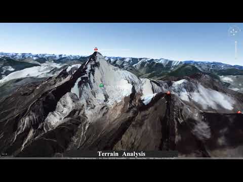
Terrain Analysis
Slope and Aspect
Used for: hydrology, conservation, site planning, other infrastructure development.
Watershed boundaries, flowpaths and direction, erosion modeling, and viewshed determination all use slope and/or aspect data as input.
Slope is defined as the change is elevation (a rise) with a change in horizontal position (a run).
Slope is often reported in degrees (0° is flat, 90° is vertical)
.
Aspect
The orientation (in compass angles) of a slope
Calculation:
Aspect = tan-1[ -(ΔZ/Δy)/(ΔZ/Δx)]
As with slope, estimated aspect varies with the methods used to determine ΔZ/Δx and ΔZ/Δy
Aspect calculations also use the four nearest cell or the 3rd-order finite difference methods.
#Geography
#Cartography
#GIS
#Remote_Sensing
#Geographer
#Cartographer
#Globe
#Earth
#Map
#Decision Making
Vineesh V,
Assistant Professor Geography,
Directorate of Collegiate Education,
Government of Kerala, India
Raster Analysis
and
Terrain Analysis.
Digital Elevation Models
Terrain Analysis
Slope and Aspect
Used for: hydrology, conservation, site planning, other infrastructure development.
Watershed boundaries, flowpaths and direction, erosion modeling, and viewshed determination all use slope and/or aspect data as input.
Slope is defined as the change is elevation (a rise) with a change in horizontal position (a run).
Slope is often reported in degrees (0° is flat, 90° is vertical)
.
Aspect
The orientation (in compass angles) of a slope
Calculation:
Aspect = tan-1[ -(ΔZ/Δy)/(ΔZ/Δx)]
As with slope, estimated aspect varies with the methods used to determine ΔZ/Δx and ΔZ/Δy
Aspect calculations also use the four nearest cell or the 3rd-order finite difference methods.
#Geography
#Cartography
#GIS
#Remote_Sensing
#Geographer
#Cartographer
#Globe
#Earth
#Map
#Decision Making
Vineesh V,
Assistant Professor Geography,
Directorate of Collegiate Education,
Government of Kerala, India
 0:18:46
 0:07:55
 0:00:33
 0:47:27
 0:15:58
 0:29:59
 0:08:33
 0:08:25
 1:11:04
 0:01:33
 0:59:17
 0:14:57
 0:15:40
 0:07:19
 0:16:13
 0:29:47
 0:17:42
 0:32:33
 0:05:28
 1:01:12
 0:06:52
 0:07:08
 0:05:49
 0:22:01