filmov
tv
Revolutionizing Design: Transforming LiDAR & Photogrammetry Data into Precision 3D CAD Models
Показать описание
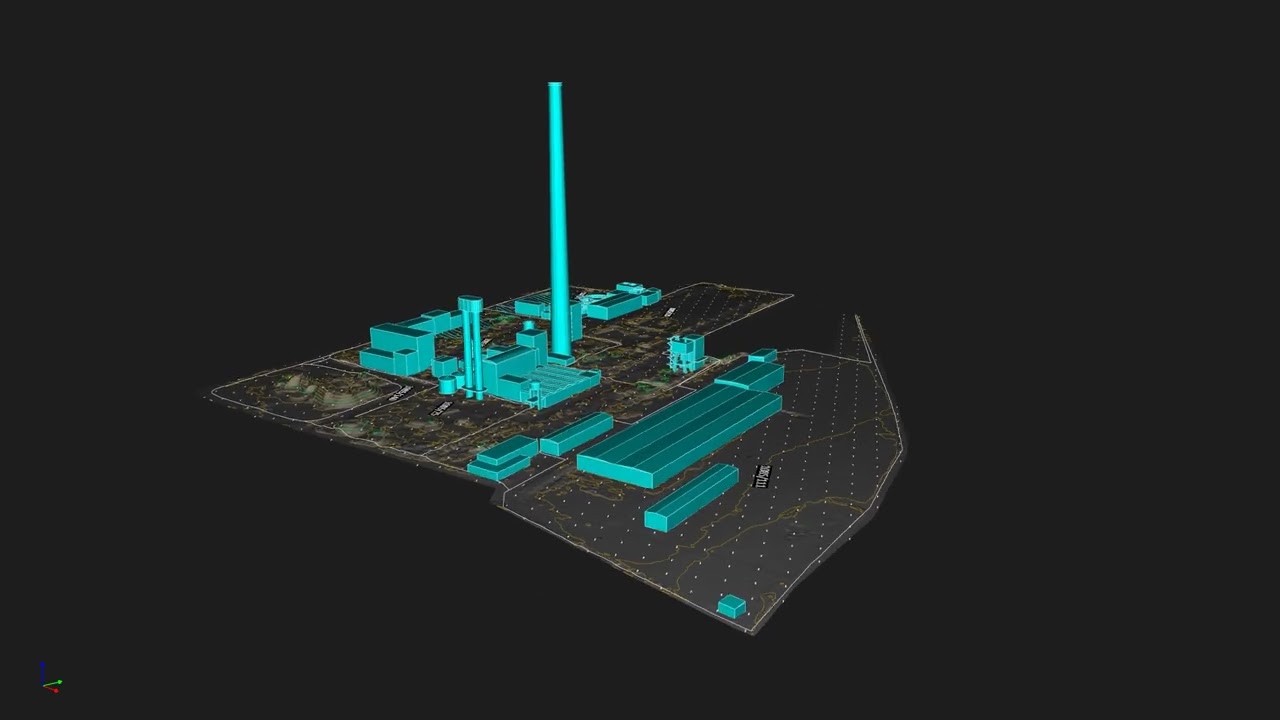
In the realm of digital surveying and 3D modeling, the integration of LiDAR (Light Detection and Ranging) and Photogrammetry technologies stands as a beacon of innovation and accuracy. Our recent project, which involved a comprehensive Pointcloud to 3D CAD solid conversion for one of our esteemed clients, exemplifies the power of these technologies in transforming complex data into precise, actionable insights.
Project Overview: A Fusion of Technology and Expertise
Our team embarked on this ambitious project with a clear objective: to harness the capabilities of LiDAR and Photogrammetry to gather detailed environmental data and convert it into a precise 3D CAD model. LiDAR technology, known for its ability to measure distances with remarkable accuracy using laser light, combined with the detailed imagery captured through Photogrammetry, provided a rich, multi-dimensional dataset.
The Challenge: From Raw Data to Refined Model
The primary challenge lay in the conversion of vast amounts of Pointcloud data into a refined 3D CAD solid model. Pointcloud data, while rich in detail, requires meticulous processing to translate into useful models. Our team utilized advanced software tools and algorithms to sift through the data, ensuring every nuance was captured in the final CAD model.
Solution: Precision Engineering and Advanced Modeling
Leveraging state-of-the-art software and our team's expertise in 3D modeling, we meticulously processed the Pointcloud data, ensuring the highest levels of accuracy and detail. The conversion process involved several stages, from initial data cleaning to the final rendering of the 3D CAD solid model. Throughout this process, our focus remained on maintaining the integrity of the original data, ensuring that the final model was a true reflection of the surveyed environment.
Outcome: Beyond Expectations
The completion of the project marked a significant milestone for our client. The 3D CAD solid model provided them with an unparalleled level of detail and accuracy, facilitating better decision-making and planning. For our team, it was a testament to the power of combining LiDAR and Photogrammetry with cutting-edge conversion techniques.
A Future-Ready Approach to Surveying and Modeling
This project not only delivered exceptional results for our client but also set a new standard for digital surveying and 3D modeling projects. As we move forward, the integration of LiDAR and Photogrammetry, coupled with advanced Pointcloud to 3D CAD conversion processes, will continue to play a pivotal role in our commitment to delivering precision, accuracy, and value to our clients.
This project serves as a benchmark for the industry, showcasing the immense potential of combining traditional surveying techniques with modern technology to achieve precision and efficiency. As we continue to explore the capabilities of LiDAR and Photogrammetry, we remain committed to delivering solutions that meet the evolving needs of our clients, pushing the boundaries of what is possible in digital surveying and 3D modeling.
 0:00:51
 0:01:47
 0:04:14
 0:01:01
 0:00:46
 0:00:36
 0:00:26
 0:00:13
 0:00:57
 0:01:01
 0:00:28
 0:00:17
 0:00:16
 0:00:16
 0:00:08
 0:00:07
 0:00:20
 0:00:50
 0:00:11
 0:00:35
 0:00:21
 0:01:41
 0:00:14
 0:00:31