filmov
tv
Tutorial N° 28 : Composite Landsat 8 bands using QGIS

Показать описание
In this tutorial we explain how to composite landsat Oli bands by Qgis, it's an very easy operation for prepapring satellite imagery to calculate all indices like : NDVI & NDWI ... Thank you for watching and don't forget to subscribe
Tutorial N° 1: Download and install QGis 3 / Télécharger et installer Qgis 3
Tutorial N° 2 : Georeferencing by QGIS / géoreferencement sous Qgis
Tutorial N° 3 : Create shapefile using QGIS / Création des couches sous Qgis
Tutorial N° 4 : Calculate Area, lenght and perimeter by Qgis
Tutorial N° 5 : Symbology using QGIS
Tutorial N° 6 : Pie symbology using QGIS
Tutorial N° 7 : Import Excel to QGis / Transfert des données excel vers Qgis
Tutorial N° 8 : Map layout by QGIS / Mise en page sous QGIS
Tutorial N° 9 : Select by location in QGis / Sélection par localisation
Tutorial N° 10 : How to merge using QGis / Grouper les objets sous Qgis
Tutorial N° 11 : Georeferencing "Map to Map" using Qgis
Tutorial N° 12 : Interpolation using QGis
Tutorial N° 13 : Topographic profile using QGIS / Coupe topographique sous QGIS
Tutorial N° 14 : Slope by QGIS / Pentes sous QGIS
Tutorial N° 15 : Longitudinal river profiles Qgis
Tutorial N° 16 : Create Hillshade using QGIS
Tutorial N° 17 : Contour map using QGIS
Tutorial N° 18 : Watershed and Drainage Delineation by Qgis
Tutorial N° 19 : Smooth line using Qgis
Tutorial N° 20 : Extract raster by QGis / Extraction des rasters
Tutorial N° 21 : Mosaicing Satellite Imagery to new raster using Qgis
Tutorial N° 22 : QGIS to Google Maps Street View
Tutorial N° 23 : Download OpenStreetMap using QGIS / telecharger la carte topographique
Tutorial N° 24 : Get NewYork, Roma, Paris AppleMaps by QGIS
Tutorial N° 25 : GeoCoding plugin using Qgis
Tutorial N° 26 : Download & add weather extension to QGis
Tutorial N° 27 : How to calculate NDVI using Landsat 8 image in Qgis
Tutorial N° 28 : Composite Landsat 8 bands using QGIS
Tutorial N° 29 : Download & install the last Qgis version 2020 : Qgis 3.16 Hannover

Tutorial N° 28 : Composite Landsat 8 bands using QGIS

Davinci Resolve Tutorial - Lesson 28 - Composite

How to Color Match Foreground and Background for Composites in Photoshop
Composite Decking Installation #diy #howto #deck #shorts

How to Match Light & Color for Composites Photoshop | Day 28

3ds Max 07-28 Composite Material

Dental Restoration ~ Composite Bonding teeth ~ 3D Medical Animation #Medical#surgery#shorts

SQL Server 28 - Composite Primary Key

DaVinci Resolve 18 - Single Node Composite Mode

Composite Map 3ds Max | MUST WATCH TUTORIAL | How to use the composite map in 3ds max

How To Blend Photos In Photoshop | Photoshop Composite Tutorial 2021

Top Composite Tips #3
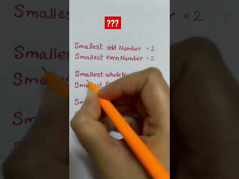
Smallest prime number? Smallest composite number? #math #youtube #tutor #shorts #shorts #mathtrick
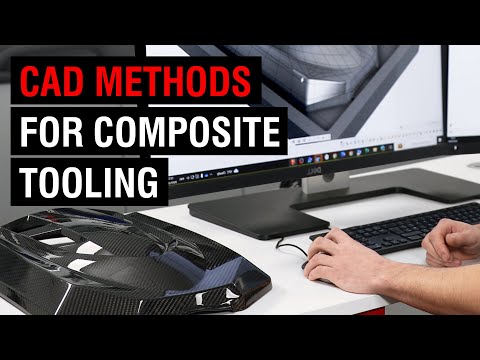
Practical CAD Techniques for Composite Pattern/Mould Design
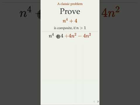
Prove n^4+4 Is Composite

Composite restoration #dentist #dentalcare #shorts

How A Composite Shingle Mounting System Works For Solar #solarcompany #residentialsolar #solarenergy

How to Create Composite Primary Key | Composite Primary key with Spring boot

Composite Preps for Board Exams - #28 DO and #30 MO - Joel N. Janis, DDS

Placing a Composite Filling #composite #resin #filling

How to Cut And Install Co-extruded Aluminum Tube #composite #tube #aluminum #outdoors #installation

How To Care For Your Composite Veneers?

These Rare Numbers are Highly Composite on Multiple Levels! #shorts
