filmov
tv
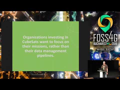
Matthew Hanson — Open Standards and Open Software for Geospatial Imagery

Показать описание
As massive amounts of new geospatial data are collected, it is increasingly challenging to search and find data of interest. New upcoming NASA missions, such as NISAR and SWOT will be generating tens of terabytes a day, while commercial small satellites (i.e., Cubesats) are launching earth observation satellites at an exponential rate. However, every data provider uses different interfaces for users to access this data, resulting in users spending significant time figuring out how to find, access, use the data, often creating customized tools for each different dataset.
Geospatial standards (led by the Open Geospatial Consortium) have been around for decades, and have proven to be vital in making data available as standardized services, but have not covered standardization of metadata fields. A new set of OGC and community-based standards aim to simplify the ability to discover and use both open public datasets, as well as commercial datasets from the emerging group of Cubesat data providers. With the development of Open Standards, common Open-Source libraries and utilities can be built to leverage this new data, providing a consistent way to access and use geospatial imagery from multiple disparate sources.
 0:54:43
 0:18:18
 0:17:03
 0:25:55
 0:15:09
 0:00:22
 0:00:51
 0:00:54
 0:03:58
 0:18:49
 0:00:28
 0:00:12
 0:00:27
 0:00:06
 0:00:23
 0:00:39
 0:19:52
 0:00:10
 0:00:29
 0:23:30
 0:27:24
 0:00:31
 0:01:01
 0:00:11