filmov
tv
Climate Change from Space

Показать описание
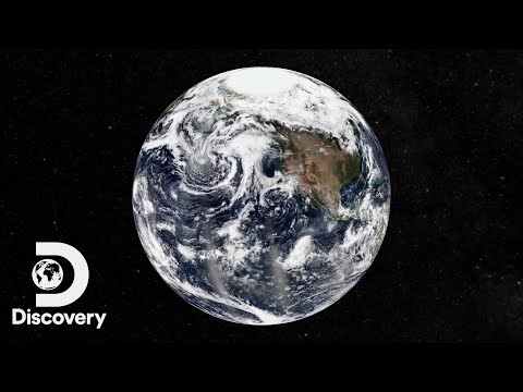
Ever wondered what climate change actually looks like? Is it the same everywhere in the world? Find out how satellites can answer these questions and what they are actually doing while watching us 24/7 all year round – even on holidays!
Nowadays, everybody uses satellite data in some way or form: from Google Maps and GPS, to over-sea phone calls and weather maps. This event will focus on showing how satellite data is used to observe climate change and to support sustainable development all over the world. You will see, how satellites use camera-like instruments to take pictures of melting glaciers, hurricanes, and other catastrophic events, which are all related to climate change.
Astrid will also explain, how we can monitor the air’s temperature and greenhouse gases all over the world, so that we can actually say, whether these are rising or falling.
In order to understand how satellites work, Astrid will show you, how satellites are built, brought into space and how they stay there. You will learn how some of the instruments on satellites work and how they can be used to not only to watch climate change happening but also how they are already being used to help people on the ground lead a more sustainable life and adapt to climate change.
Please post your questions for Astrid in the chat.
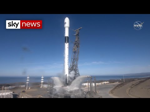
The David Elder lectures, in partnership with the University of Strathclyde, will return on the 7 October at 1900 on YouTube and Facebook Live. Join NASA’s Dr. Benjamin Hamlington as he discusses how satellites are used to understand changing sea levels.
Nowadays, everybody uses satellite data in some way or form: from Google Maps and GPS, to over-sea phone calls and weather maps. This event will focus on showing how satellite data is used to observe climate change and to support sustainable development all over the world. You will see, how satellites use camera-like instruments to take pictures of melting glaciers, hurricanes, and other catastrophic events, which are all related to climate change.
Astrid will also explain, how we can monitor the air’s temperature and greenhouse gases all over the world, so that we can actually say, whether these are rising or falling.
In order to understand how satellites work, Astrid will show you, how satellites are built, brought into space and how they stay there. You will learn how some of the instruments on satellites work and how they can be used to not only to watch climate change happening but also how they are already being used to help people on the ground lead a more sustainable life and adapt to climate change.
Please post your questions for Astrid in the chat.
The David Elder lectures, in partnership with the University of Strathclyde, will return on the 7 October at 1900 on YouTube and Facebook Live. Join NASA’s Dr. Benjamin Hamlington as he discusses how satellites are used to understand changing sea levels.
 0:01:35
 0:03:29
 0:05:05
 0:02:53
 0:04:32
 0:06:04
 0:02:53
 0:08:46
 0:07:57
 0:27:15
 0:20:55
 0:08:34
 0:03:01
 0:05:27
 0:05:12
 0:06:52
 0:13:13
 1:03:47
 0:04:21
 0:23:54
 0:00:43
 0:07:36
 0:03:56
 0:03:25