filmov
tv
Все публикации

How to Calculate the Area and Percentage Land Use Land Cover (LULC) Classes

How to Clip Raster data (.TIF) with a Polygon (shapefile) in ArcGIS

How to Create Intersecting Circles of Equal Radius

How to Download FREE ESRI Land Cover Data (2017 - Present)

How to Make Your First Map Using QGIS - Easy Steps

How to Record a tour in Google Earth

How To Group Multiple Layers Into One Layer in QGIS

How to Calculate Reachability (Isochrones) and Travel Time using ORS Tools

How to Calculate the Shortest and Fastest Routes in QGIS (Open Routing Services-ORS)

How to Make a Graduated Symbol Map in QGIS

How to Search for Coordinates and Addresses Directly on QGIS

How To Convert Coordintes Format From Degrees Minute Seconds to Decimal Degrees in Google Earth Pro

How To Create Elevation Profile in Google Earth and Plot Chart in Excel

How to Import csv, shapefile and tif (Raster, Vector) files into Google Earth Pro

How to View Historic Imagery (old Maps) in Google Earth Pro of any location

How to Download High Resolution Satellite Images Free from Google Earth Pro
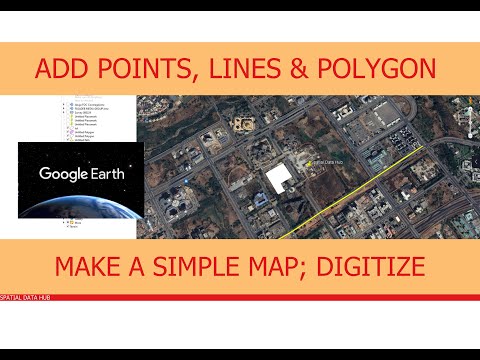
How to Create Point, Lines, Polygons in Google Earth Pro – Digitization

How to Measure Distance Between Two Points, Area, radius, 3D Buildings.

How to Navigate Google Earth Pro: Understand Interface, Unique Features, More

Welcome to Your Course: A Complete Guide on Google Earth Pro

How to calculate the Distance between two points, Average and Multi-points

Select Features (Pionts, Lines, Polygons) Based on Their Location

Save QGIS Attribute Table as Excel Spreadsheet (CSV, XLSX)
