filmov
tv
Spatial Data Analysis with Python: Utilizing Python libraries for geospatial data analysis.

Показать описание
In geospatial analysis, working with spatial datasets and applying appropriate tools for data processing and visualization is essential for deriving meaningful spatial insights. Python provides a flexible and efficient platform for handling these tasks through its extensive library support.
In this session, we explored the fundamentals of Spatial Data Analysis using Python. The objective was to familiarize participants with key spatial data formats, Python environments, and geospatial libraries necessary for spatial data processing and analysis.
The session covered:
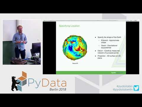
An introduction to spatial data types and formats such as GeoTIFF, Shapefiles, and other common vector and raster datasets
Setting up a dedicated Python environment tailored for geospatial data analysis
Utilizing Python libraries including GeoPandas for managing spatial vector data, Shapely for geometric operations, and Rasterio for raster data processing
Demonstrating the use of Contextily, Folium, and Matplotlib for creating both static and interactive spatial visualizations
Through practical examples and demonstrations, participants gained hands-on experience in handling, analyzing, and visualizing spatial data using Python libraries. This workflow highlights Python’s capability in supporting efficient and scalable geospatial data analysis across various application areas.
In this session, we explored the fundamentals of Spatial Data Analysis using Python. The objective was to familiarize participants with key spatial data formats, Python environments, and geospatial libraries necessary for spatial data processing and analysis.
The session covered:
An introduction to spatial data types and formats such as GeoTIFF, Shapefiles, and other common vector and raster datasets
Setting up a dedicated Python environment tailored for geospatial data analysis
Utilizing Python libraries including GeoPandas for managing spatial vector data, Shapely for geometric operations, and Rasterio for raster data processing
Demonstrating the use of Contextily, Folium, and Matplotlib for creating both static and interactive spatial visualizations
Through practical examples and demonstrations, participants gained hands-on experience in handling, analyzing, and visualizing spatial data using Python libraries. This workflow highlights Python’s capability in supporting efficient and scalable geospatial data analysis across various application areas.
 0:37:06
 0:08:28
 0:47:15
 2:04:52
 1:00:22
 0:08:39
 0:37:06
 0:06:31
 0:21:08
 0:00:43
 0:09:04
 0:00:57
 0:01:55
 0:37:24
 0:02:29
 1:43:21
 0:08:10
 1:09:34
 0:27:11
 0:00:37
 3:08:03
 2:52:02
 0:00:58
 0:03:25