filmov
tv
Beautiful place in the world (New zealand)- ultra 4k

Показать описание
Beautiful place in the world (New zealand)- ultra 4k:
New Zealand is an island country in the southwestern Pacific Ocean. The country geographically comprises two main landmasses—the North Island , and the South Island and around 600 smaller islands. New Zealand is situated some 1,500 kilometres (900 mi) east of Australia across the Tasman Sea and roughly 1,000 kilometres (600 mi) south of the Pacific island areas of New Caledonia, Fiji, and Tonga. Because of its remoteness, it was one of the last lands to be settled by humans. During its long period of isolation, New Zealand developed a distinct biodiversity of animal, fungal and plant life. The country's varied topography and its sharp mountain peaks, such as the Southern Alps, owe much to the tectonic uplift of land and volcanic eruptions. New Zealand's capital city is Wellington, while its most populous city is Auckland.
New Zealand is located near the centre of the water hemisphere and is made up of two main islands and a number of smaller islands. The two main islands (the North Island, or Te Ika-a-Māui, and the South Island, or Te Waipounamu) are separated by Cook Strait, 22 kilometres (14 mi) wide at its narrowest point. Besides the North and South Islands, the five largest inhabited islands are Stewart Island, Chatham Island, Great Barrier Island (in the Hauraki Gulf), d'Urville Island (in the Marlborough Sounds) and Waiheke Island (about 22 km (14 mi) from central Auckland).
New Zealand is long and narrow (over 1,600 kilometres (990 mi) along its north-north-east axis with a maximum width of 400 kilometres (250 mi), with about 15,000 km (9,300 mi) of coastline[136] and a total land area of 268,000 square kilometres (103,500 sq mi). Because of its far-flung outlying islands and long coastline, the country has extensive marine resources. Its exclusive economic zone is one of the largest in the world, covering more than 15 times its land area.
The South Island is the largest landmass of New Zealand and is the 12th largest island in the world. It is divided along its length by the Southern Alps. There are 18 peaks over 3,000 metres (9,800 ft), the highest of which is Aoraki / Mount Cook at 3,754 metres (12,316 ft). Fiordland's steep mountains and deep fiords record the extensive ice age glaciation of this south-western corner of the South Island. The North Island is the 14th largest island in the world and is less mountainous but is marked by volcanism. The highly active Taupo Volcanic Zone has formed a large volcanic plateau, punctuated by the North Island's highest mountain, Mount Ruapehu (2,797 metres (9,177 ft)). The plateau also hosts the country's largest lake, Lake Taupo, nestled in the caldera of one of the world's most active supervolcanoes.
This video is about exploring the new zealand
check out my other videos also:
if u want to use this content contact me:
keep supporting...
-~-~~-~~~-~~-~-
Please watch: "Sony 4K Video - Surfing the Waves in Dolby DTS Ultra HD 60 FPS"
-~-~~-~~~-~~-~-
 0:59:28
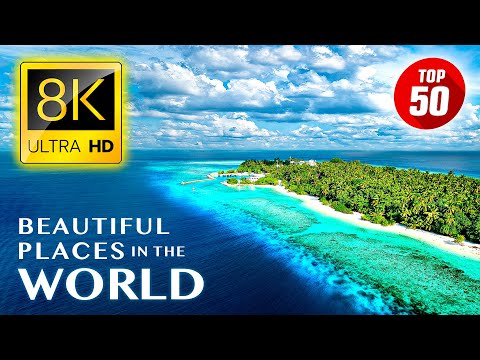
TOP 50 • Most Beautiful Places in the World 8K ULTRA HD
 3:00:22
UNREAL WONDERS OF PLANET | The Most Beautiful Places to Visit in The World |Travel Video 4K
 3:55:59
Most Beautiful Places in The World in 4K Dolby Vision
 0:10:44
12 Most Beautiful Places on Planet Earth
 0:00:17
Most beautiful places in the world #travel #explore #adventure #nature
 0:00:16
Most beautiful places in the world #travel #explore #adventure #india
 0:00:13
Amazing Places In The World 😍🌎 #place #nature #explore #travel
 1:01:24
UNREAL WONDERS OF PLANET EARTH | The Most Beautiful Places in The World | Travel Video 4K
 0:00:16
Most beautiful place in the world 🌎 in India, Island #beautiful #place #world #shortvideo #subscribe...
 0:00:15
Amazing World's Beauty Places 🌍 That Don't Feel Real 😱😍#adventure #explore #travel #nature...
 0:00:16
Most beautiful places in the world #travel #explore #adventure #india
 1:00:42
UNREAL WONDERS OF PLANET | The Most Beautiful Places to Visit in The World |Travel Video 4K
 0:00:16
Most amazing places on earth 🌍 #adventure #travel #explore #nature #shorts #shortsfeed #viralshorts...
 1:00:26
Most Beautiful Places in the World 4K - Scenic Relaxation Film With Beautiful Relaxing Music
 0:49:46
SWITZERLAND'S MOST BEAUTIFUL PLACES ON THE STORM 🌧️ LAUTERBRUNNEN - THE HIDDEN SWISS PARADISE...
 2:33:49
TOP 10 THE MOST BEAUTIFUL PLACES IN THE WHOLE WORLD 🌞 THE TRUE TOURIST JEWELS
 0:22:02
20 Most Beautiful Places On Planet Earth
 0:13:12
20 Most Dangerous Tourist Attractions in the World
 1:46:56
Most Beautiful Cities in the World to Visit in 2025 | 4K Travel Guide
 0:00:15
Places On Earth That Don't Feel Real #trending #viralvideo #shorts #travel #adventure
 1:50:14
50 Most Beautiful Places To Visit In Europe in 2025 | 4K Travel Guide
 0:00:16
Most beautiful places in the world #travel #adventure
 0:00:17
Most beautiful places in USA #travel #explore #adventure #nature
 1:11:02
UNSEEN WONDERS | Hidden Places Even Locals Can’t Believe Exist | Travel Video 4K
Комментарии