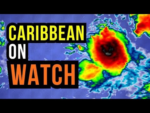
A Tropical Storm Is Looking More Likely...

preview_player
Показать описание
Invest 97L has a big chance of becoming our next tropical storm or hurricane as it moves through the Gulf Of Mexico near Florida. Latest models like the HWRF & GFS show this becoming a hurricane near Florida's big bend. However, it also shows that tropical storm or hurricane stalling out for a couple of days in this area, which, if that happens, could bring catastrophic impacts to this area. So, in today's detailed tropical weather forecast, we'll break down all of those details.

Video Chapters:
0:00 - Intro
0:10 - Tracking Invest 97L
2:58 - NHC Increases Chances More
3:43 - How Strong Will 97L Get?
8:58 - More Concerning Pattern Developing
12:29 - Lots Of Rain Coming
14:49 - Worse Case Scenario Possible
15:44 - Latest 12z Ensambles
19:56 - What's The Ceiling For 97L?
21:11 - Gulf Watern Nearing 91F Now!!!!
23:22 - Reviewing
24:27 - Outro/Promotion

Checkout My Website:

Subscriber Here For More Weather Content!!!!!

Join this channel to get access to perks:

Sacramento Weather Center Group:

WeatherForce Discord Server:

Disclaimer: All of my videos and live streams are for entertainment purposes only, and to discuss raw operational model guidance and its ensembles, I'm also comparing models too. So please seek official sources like the National Weather Service, National Hurricane Center, or The Weather Channel for more detailed and accurate information.

My Social Media:
Рекомендации по теме
Комментарии
Автор

Hey David, here’s some suggestions for your viewers. This is one of the most complicated forecasts that can possibly be set up. There’s no closed circulation, therefore the forecast and model runs very medium confidence in the future trends. We will get a better forecast over the weekend, so don’t believe social media posts explaining there’s a major hurricane that will sit off the coastline of the Panhandle Of Florida and then Georgia/South Carolina. Social media content creators get a lot of views when they mention major hurricanes and Gulf Coast for some reason. So take the models with a grain of salt, but we’re not that far away from Sunday. So be prepared, stay updated and make sure you’re receiving updates from credible sources. Thanks David 😊

gregd
Автор

I just really like your reports David.That hot water in the gulf is concerning.Happy to hear you will give rapid reports.

heidiesterholm
Автор

I cancelled my trip to Daytona Beach this weekend. Not taking chances

MeadeSkeltonMusic
Автор

Thank you for your update David.
Please ignore and delete comments that are mean. They are just trying to make you react and they are getting it when you do!

dianathefiberfan
Автор

Watching and preparing from the Panhandle of Florida, the probability of 30 plus inches of rain is very concerning. Our area has already been soaked from several days of rain, the natural water sheds are full, this reminds me of when hurricane Eloise came to the Panhandle in 1975. Hurricane then flooding, a one - two punch, the community I lived in took years to recover back then.

t.d.harris
Автор

Hello David. It's a pleasure to see you again. I have been monitoring this storm system since I first got up this morning. This System may be a bit difficult to accurately predict as to where it may impact Florida. The system is starting to look a bit well organized and well defined.

williamgaudette
Автор

I was just wonderin, was David. S.going to be talking about this Storm....and. Whammo!! Here's yer Video..

Ken-dmkd
Автор

So basically folks in Pensacola need to build an ARK just in case??

mjg
Автор

Hello David...shaking my head at this system lol. Like I said before, this system(prob be debbie), DOES NOT want anyone to know where it is going. Agree, we will not know for sure until it gets South of Key West. Florida, regardless, needs to be prepared, esp for how much rain fall they will get. I can see videos on cars swamped by water. Thanks for going thru this and keeping up with it. Looking to your next update.

colleenpriest
Автор

Great job sir. Appreciate all the hard work you put in. Keep up the great work and thank you🥇

frankmatos
Автор

Just a note of reminder to all Florida residents that once a cone does appear that the little black line located inside the cone of uncertainty is not to be the only primary focus because these storms can wobble around so that needs to be taken into account from those located in any storms path. Some Tropical System can be very large in size so impacts can be felt far from the center.

williamgaudette
Автор

ICON model did very well with Hurricane Beryl

briankelly
Автор

Sounds it will be like hirricanes beryl katrina, harvey or mitch (maybe laura). That is debby

pgbomsi
Автор

Great analysis, David! You do great work on these scenarios. Im in SW Florida and was nuked by Ian in Fort Myers.

KrisMIW
Автор

Cedar Key and Nature coast is concerning. Definitely need to watch.

pm
Автор

Great breakdown David. Nice work.
Sub added.

tomchidwick
Автор

W vid David as always, anyways my question is could this become a major hurricane?

DJtechAndGaming
Автор

Evening David. Looks like rain for SC.

wolmntn
Автор

Cubas the wild card. Cubas interaction will determine where the Low re centers. If it’s the west side of Cuba, more of the Harvey track. East side of Cuba probably some RI but nothing like the western track. It’ll probably beat the H and be pushed to sea.

hjcK
Автор

I think it's still a bit early to have confidence or concern and a bit alarmudt yo suggest otherwise. That said given the loop around/ stalling in a few of the models I hope Floridians are taking note. Houstonian that dealt with Harvey, I would not wish that on anyone but not sure even with a trusted forecast we could have prepared.

chelseyshelledy